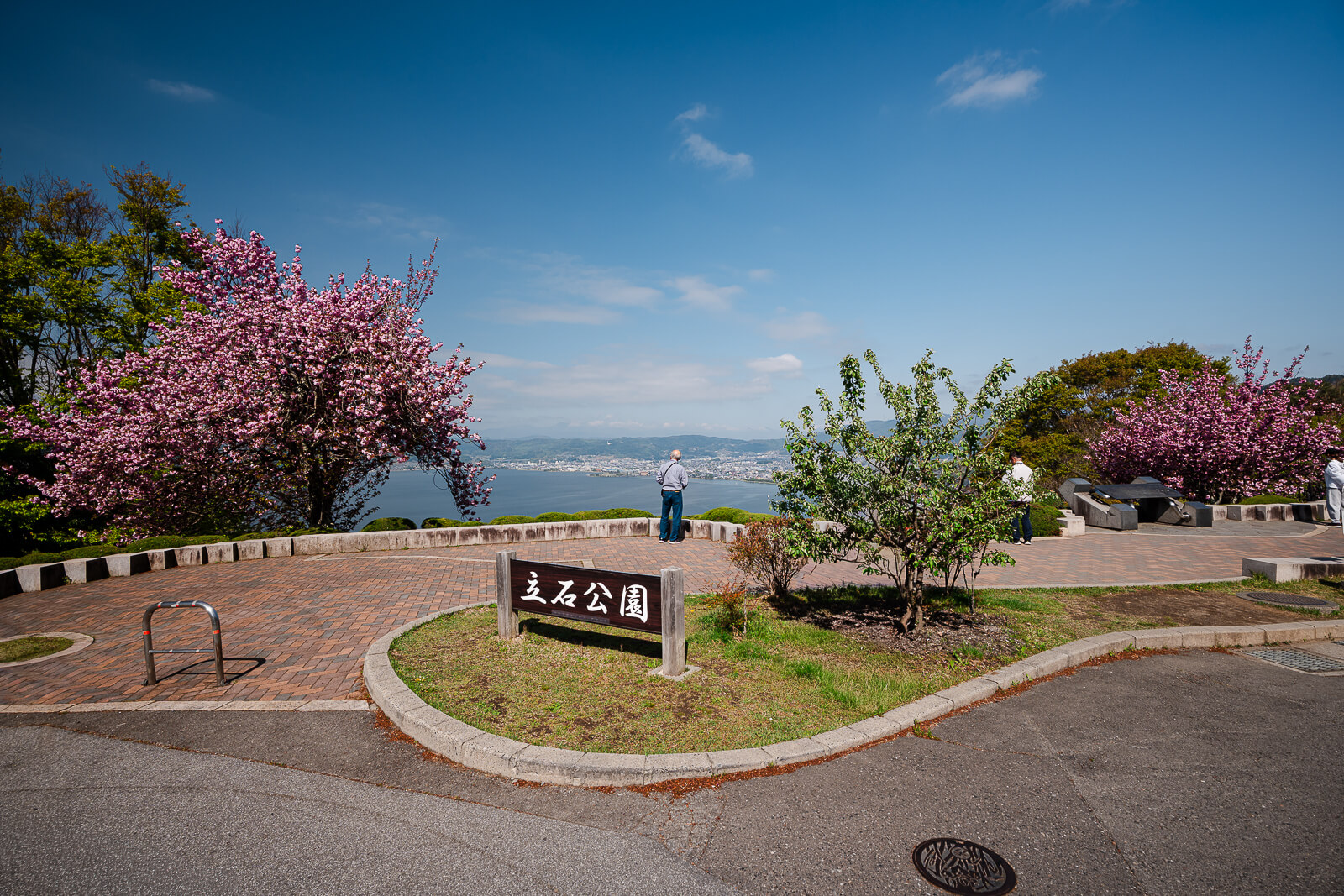
Seeing Lake Suwa From the Hills Above Suwa City
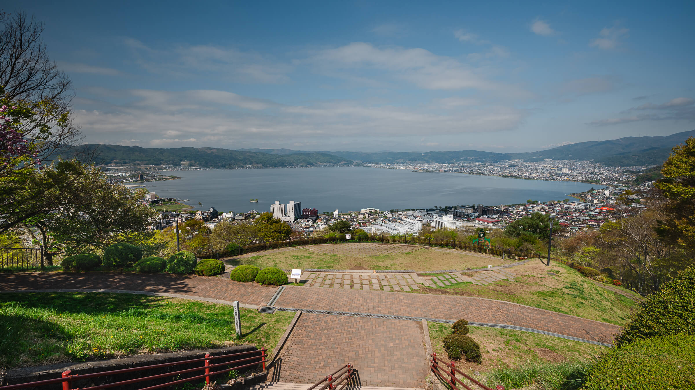
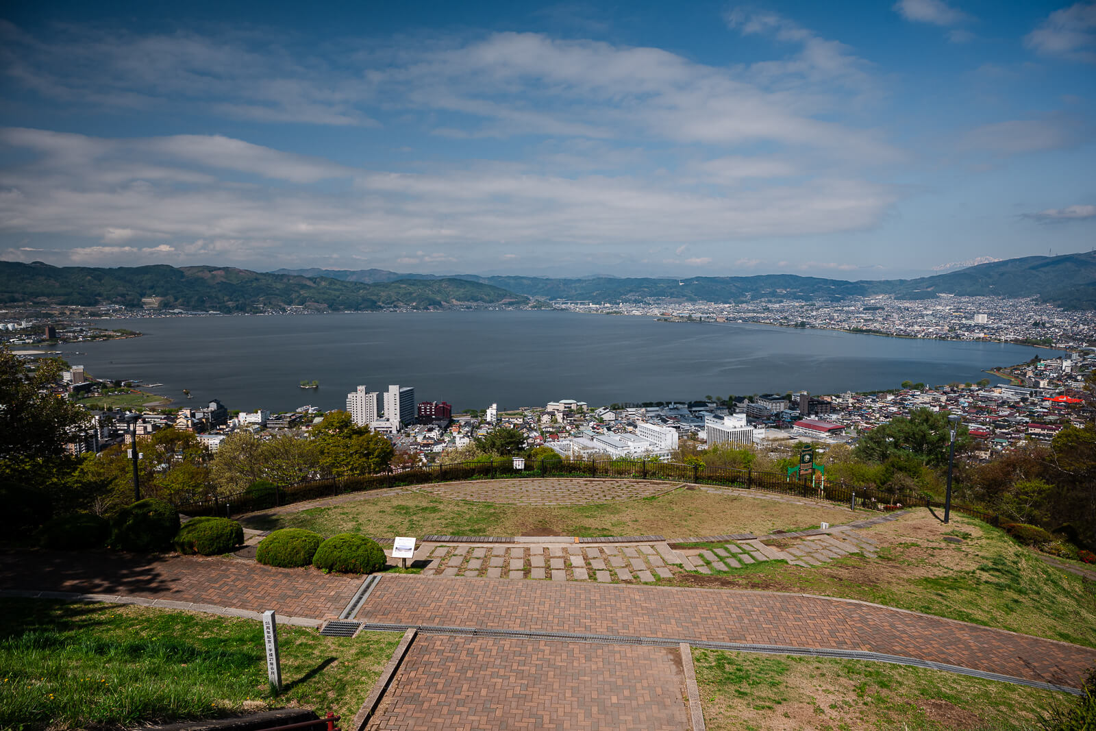
High above the eastern side of Lake Suwa in Nagano Prefecture, Tateishi Park overlooks the basin above the Kamisuwa side of Suwa City. The viewpoint sits uphill from Kamisuwa Onsen, within driving reach of places such as Takashima Castle, Katakurakan, and the lakeshore near Sekicho Park. From this elevation, the lake, shoreline roads, rail lines, and surrounding towns begin reading as one connected landscape instead of separate stops around the water.
Most people come for the overlook near sunrise or sunset, when the changing light creates more separation between the shoreline, cities, and mountain edges. The stop itself is short. Most visits last somewhere between 20 and 45 minutes once at the top.
Walking effort is minimal once the parking area is reached. The access changes the equation more than the terrain does. Tateishi Park fits most naturally into a wider route around Lake Suwa, especially for travelers already moving between shoreline districts, shrine areas, and viewpoints by car. For the full planning context, the Lake Suwa Guide explains where to stay, how long to spend, and how the lakeside stops connect.
Why the Basin Looks Different From Above
From the shoreline, the basin rarely feels compressed. Roads bend around the lake gradually, towns spread behind the water, and the surrounding mountains often disappear behind buildings or weather. The relationship between Suwa City, Kamisuwa, Okaya, and Shimosuwa becomes clearer once the elevation changes.
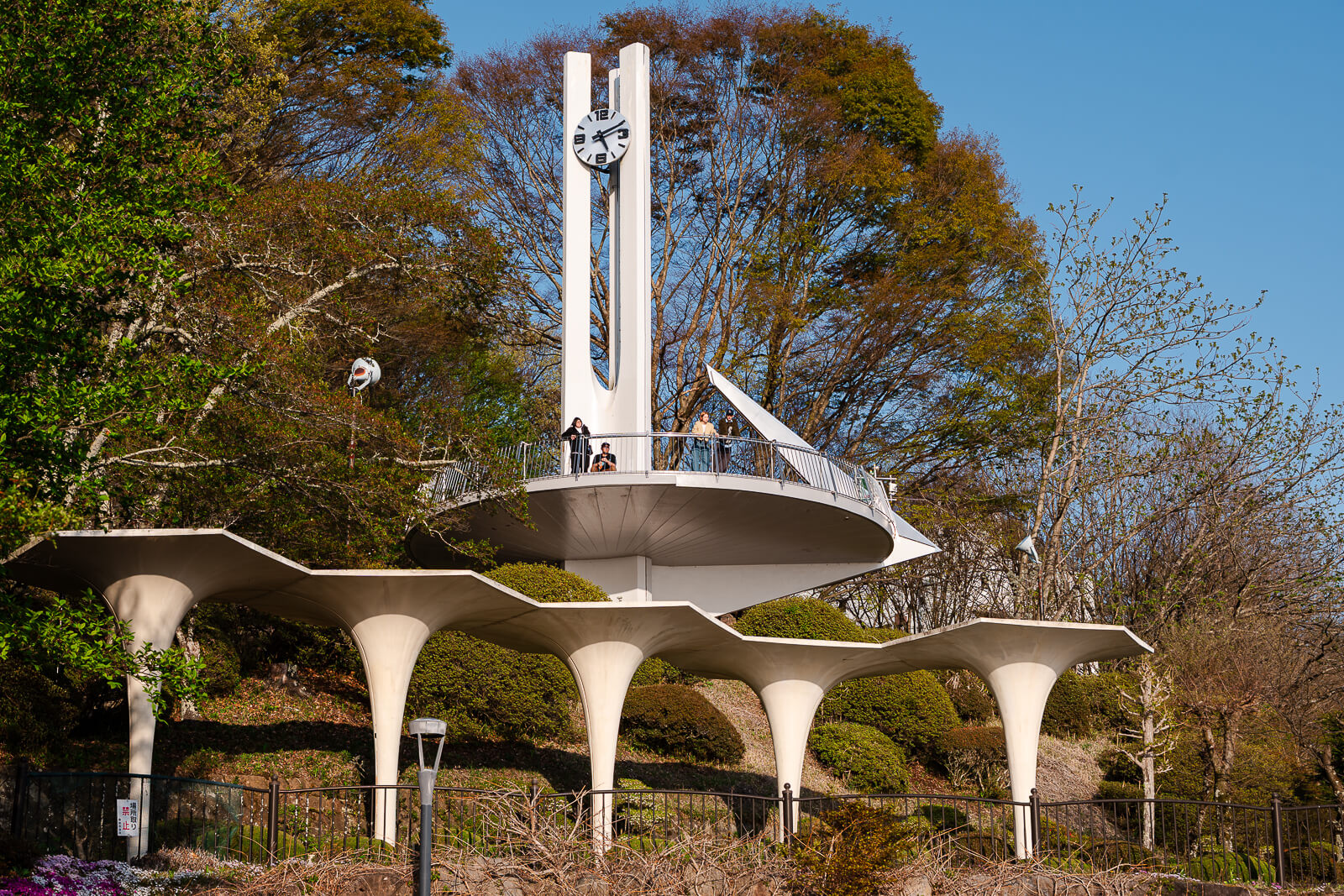
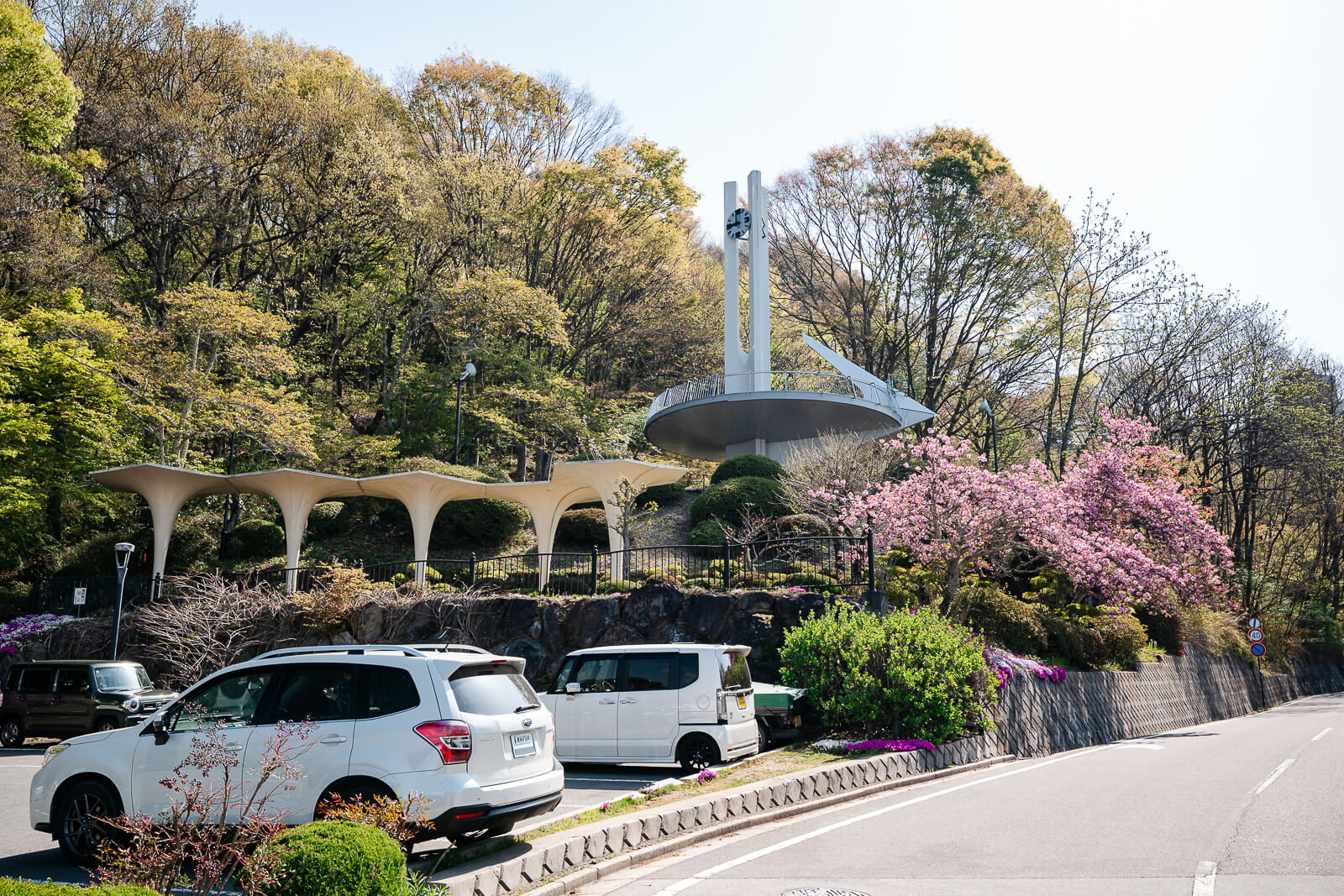
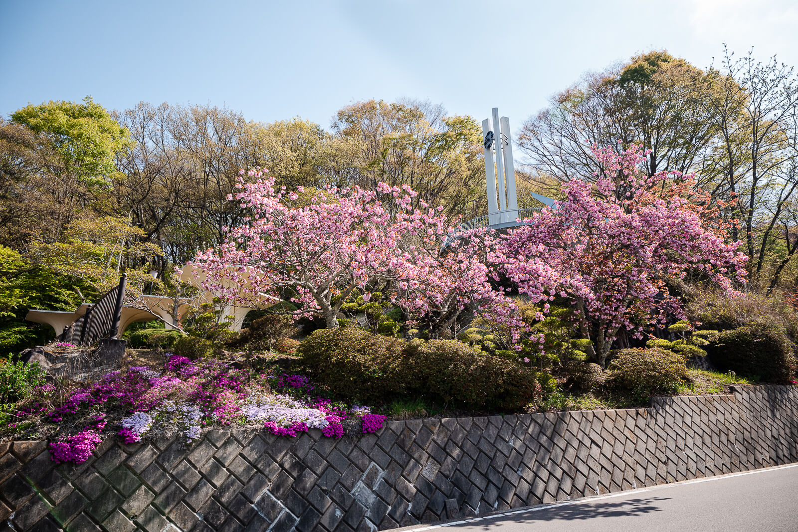
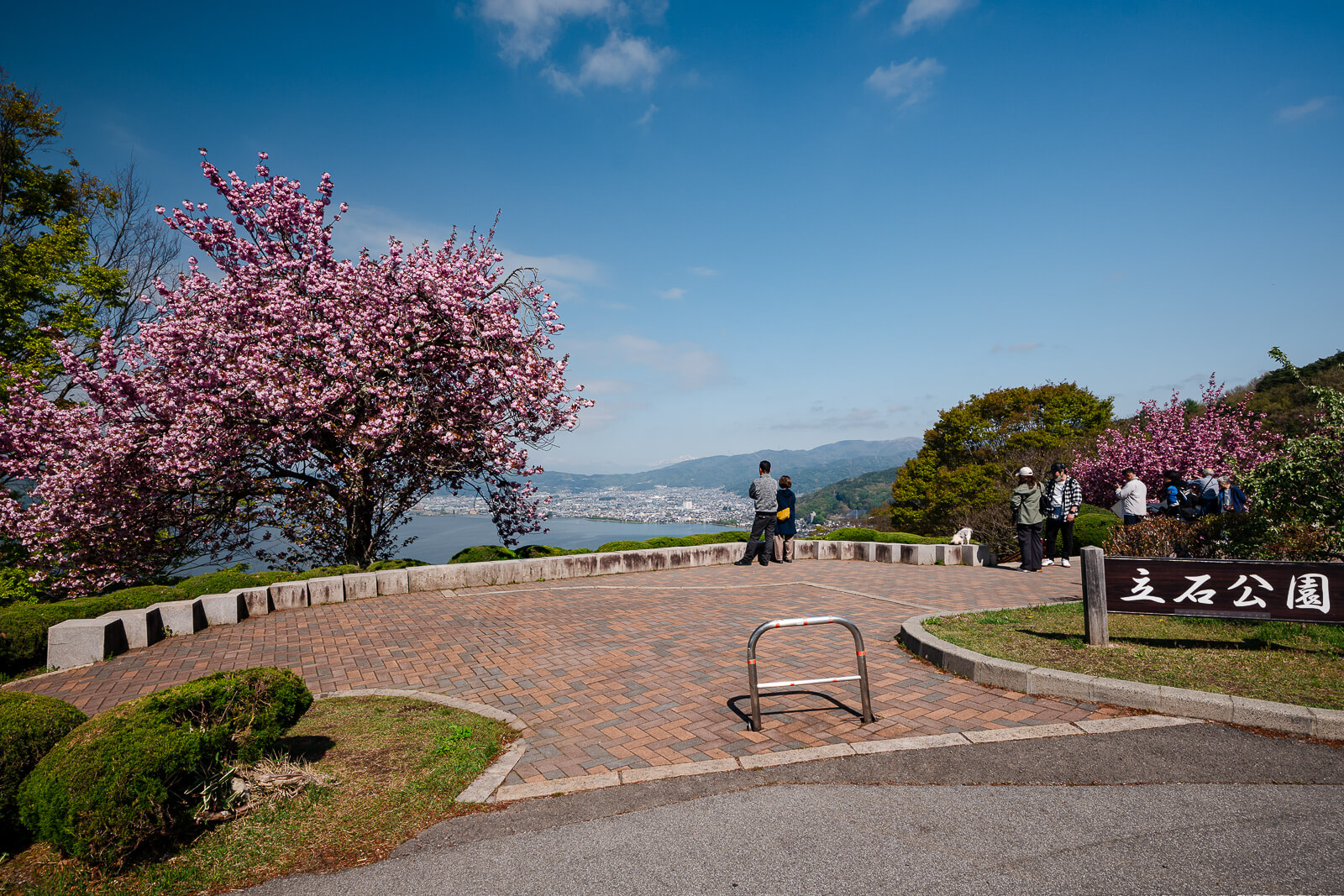
The overlook itself is relatively simple. There are no large gardens, long walking routes, or major facilities pulling attention away from the view. The geography becomes the focus instead.
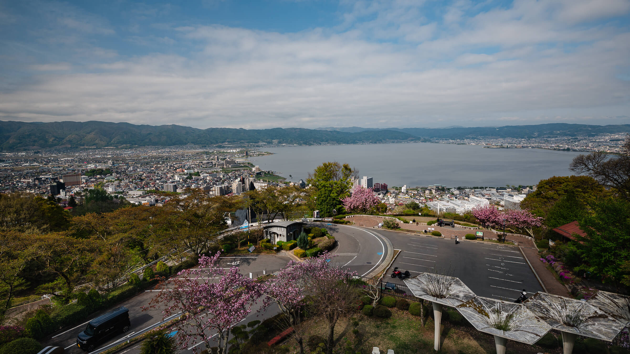
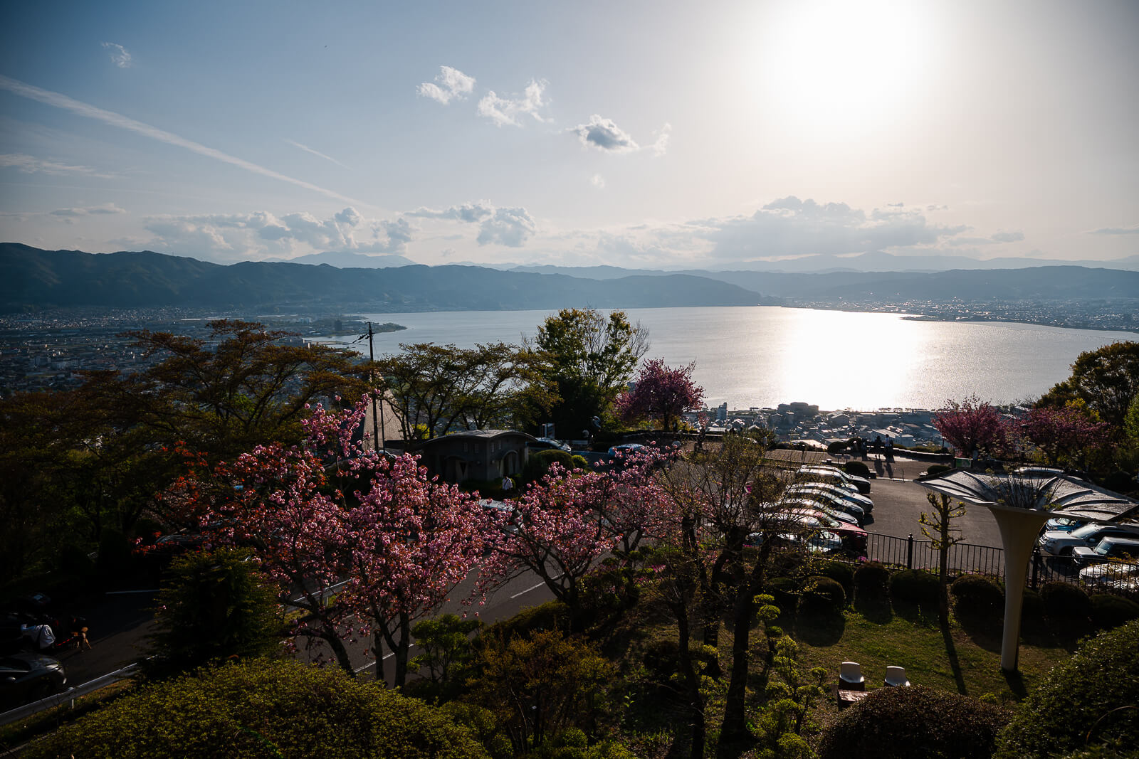
From above, the lake appears gathered tightly between surrounding slopes and urban districts. Rail corridors, shoreline roads, parks, shrine areas, and lakeside hotels begin fitting together into a shape that is harder to recognize from ground level. Places such as Takashima Castle, Katakurakan, and the roads near Kamisuwa Onsen start feeling less isolated from one another afterward.
Before the Basin Filled With Roads and Hotels
Long before the shoreline filled with hotels, roads, and rail lines, the Lake Suwa basin functioned as a narrow corridor between surrounding mountains. Movement through the region compressed naturally around the water, with settlements forming where flatter land opened beside the lake or along routes connecting the basin to surrounding valleys. The slopes above Suwa provided one of the few ways to see how tightly the region gathered together geographically.
The wider area also developed around the influence of Suwa Taisha, whose shrine network spread across both the lower lakeside districts and the upper foothill areas extending toward Chino. Roads, settlements, and agricultural land gradually filled the basin over centuries, though the surrounding mountain walls still define the region much the same way they did earlier travelers approaching the lake from the passes beyond the basin.
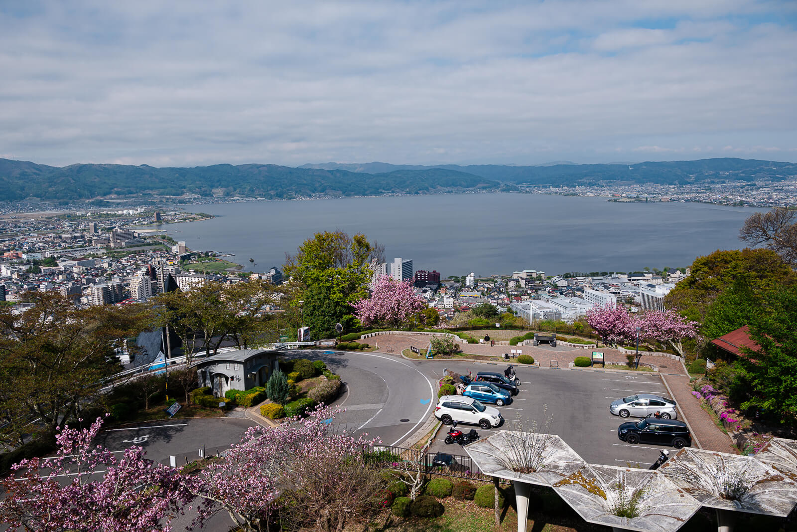
From Tateishi Park today, modern roads, rail lines, hotels, and urban districts now occupy much of the shoreline below. The overlook changes how those pieces connect visually. What appears fragmented at ground level begins reading as one compressed landscape shaped by the lake, surrounding mountains, and the narrow space between them.
Leaving the Shoreline Behind
The climb begins in the flatter streets near the lake before pulling upward into residential roads above Suwa City. Gaps between houses and roadside trees begin opening partial views across the water before the overlook itself appears. The transition happens gradually enough that the viewpoint still feels tied to the city below.
The road narrows as it climbs. Curves tighten near the upper sections, especially close to the parking area. Around sunset, autumn foliage season, and clearer weekends, traffic can slow noticeably because local visitors and travelers often arrive during the same viewing windows.
From the parking area, the remaining walk is short. The overlook appears quickly once the elevation opens toward the basin. The stop revolves around the shift in perspective more than movement through the park itself.

Seeing How the Basin Connects Together
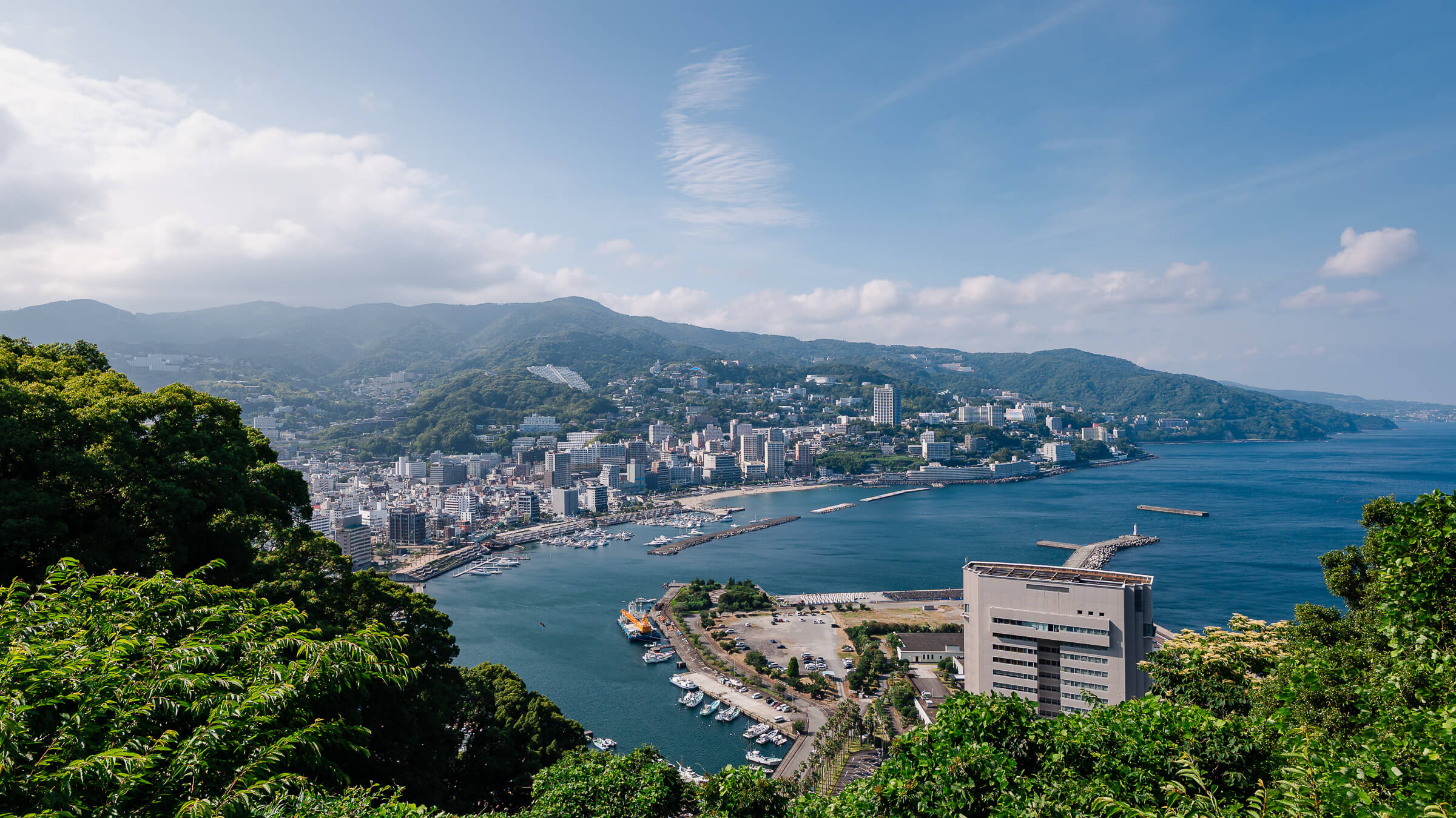
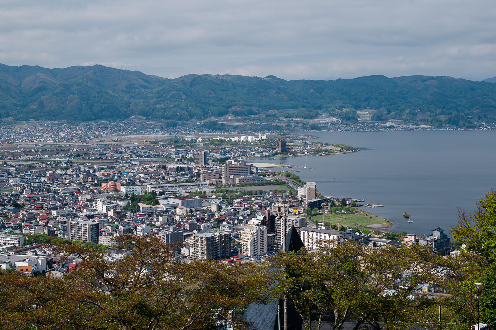
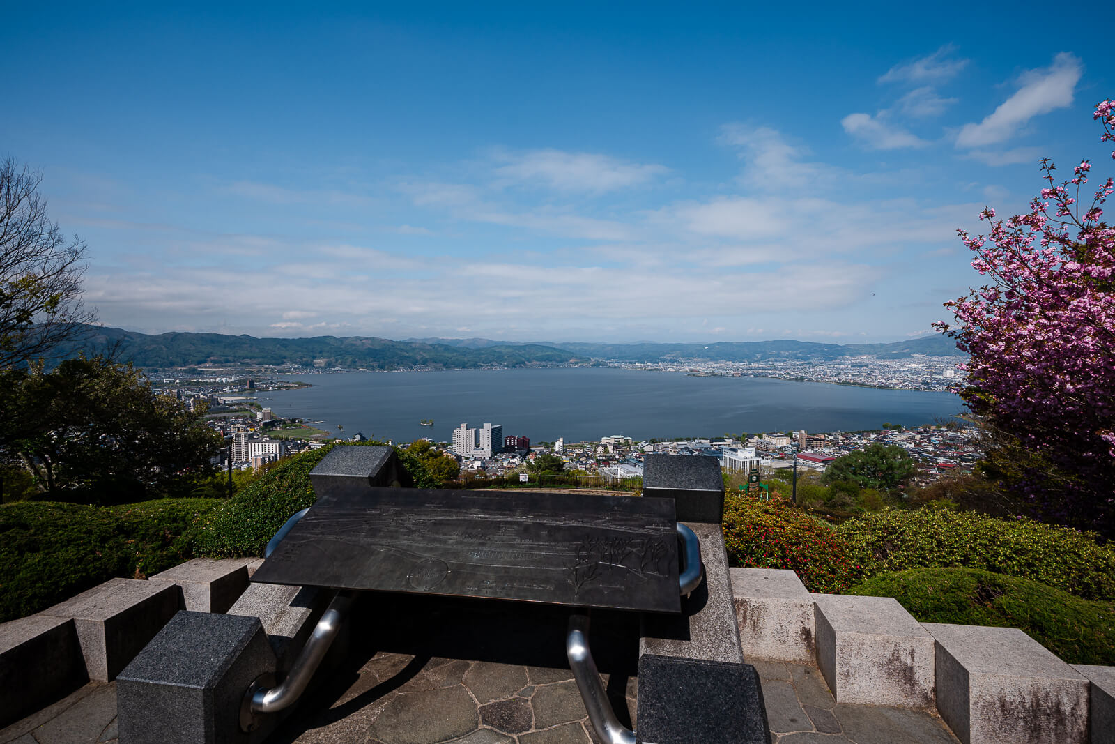
From the observation area, Suwa City spreads across much of the eastern and southern shoreline below. The hotels and roads of Kamisuwa Onsen continue along the water, while Okaya occupies the northern side of the basin and Shimosuwa sits closer to the northeastern edge.
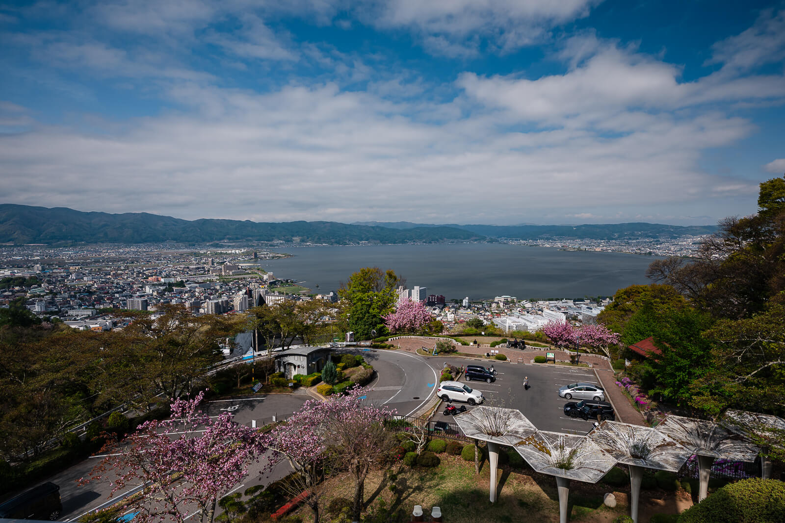
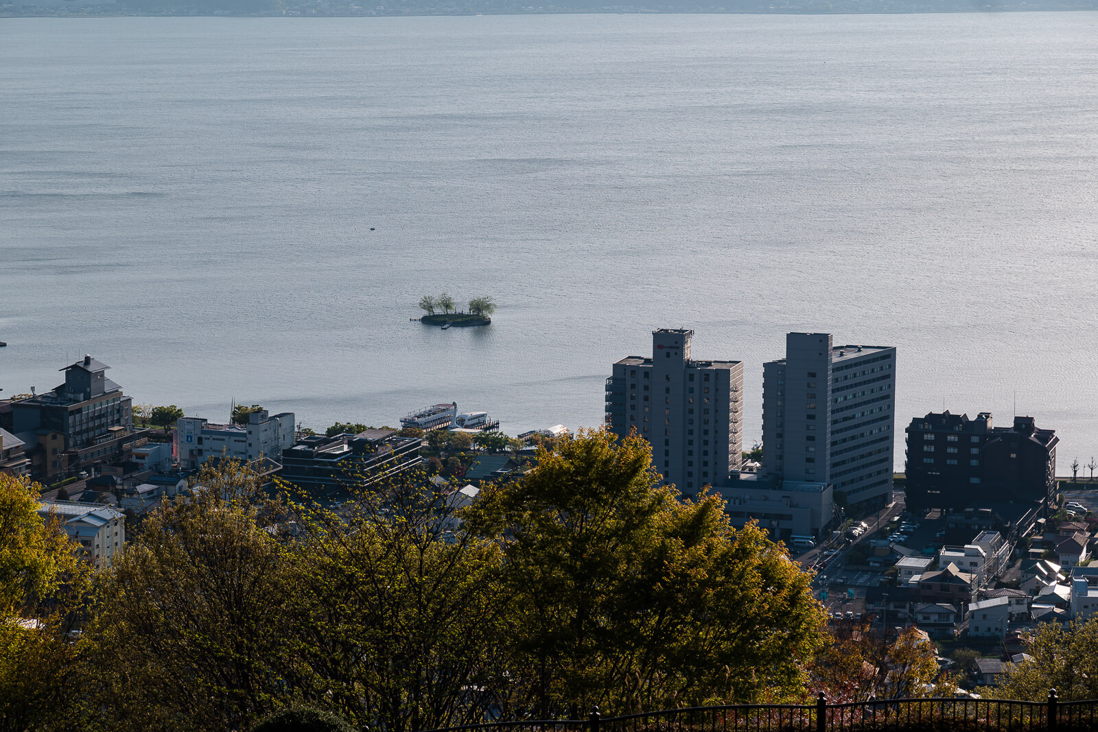
Several lakeside landmarks become easier to separate once visibility improves. The shoreline near Sekicho Park, Katakurakan, the Lake Suwa Geyser Center, and the Kitazawa Museum of Art helps define the Kamisuwa side of the lake, while Takashima Castle stands near the western shoreline below.
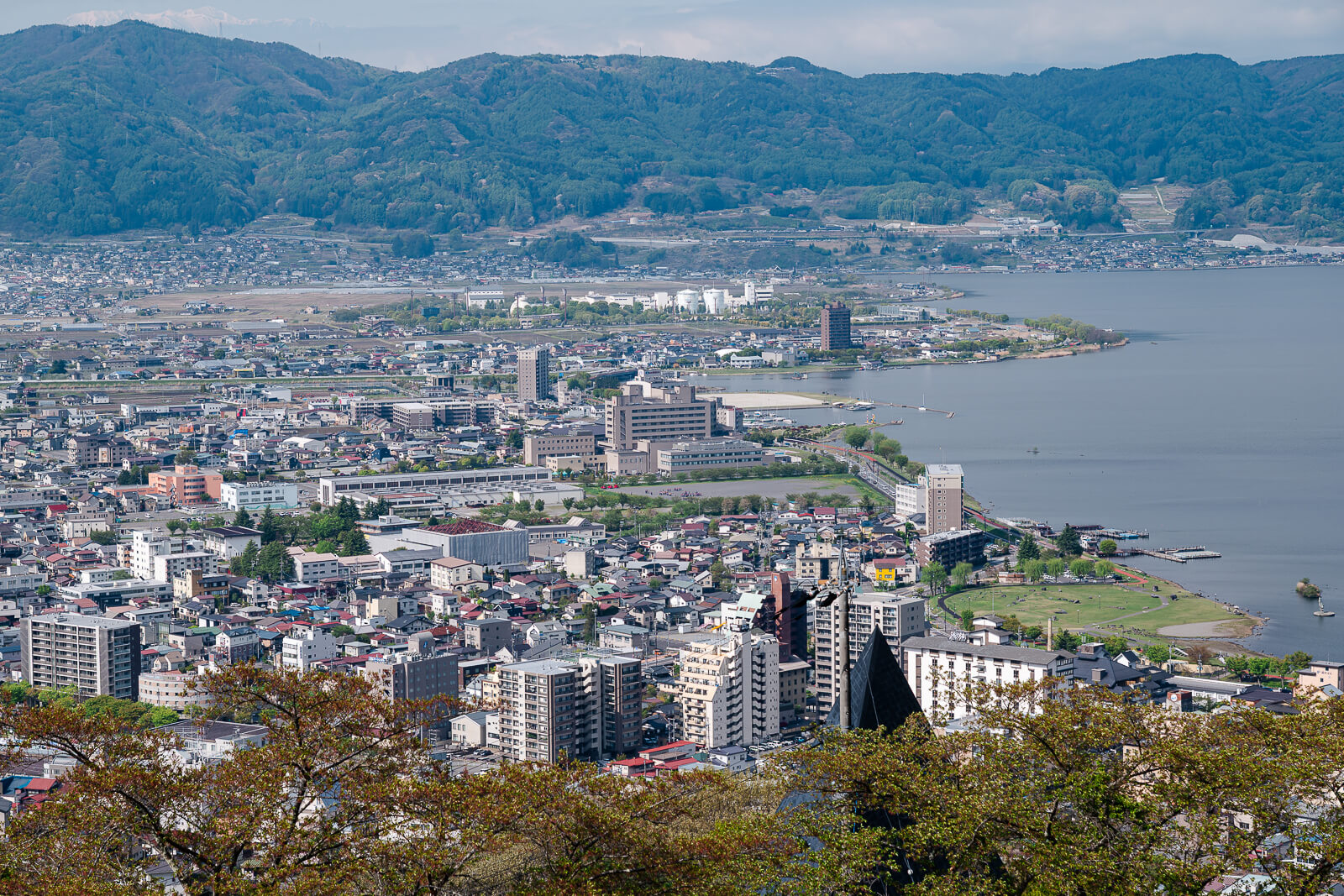
Across the water, the northern shoreline pulls the view toward Okaya and the highway side of the basin. From this elevation, the Suwako Service Area area can also be picked out along the expressway above the lake, adding another reference point for travelers who first encounter Lake Suwa from the highway before exploring the shoreline itself.
When the Shoreline Begins to Separate
The overlook changes noticeably depending on light and weather. Midday visibility can still stretch across the basin, though direct overhead light often flattens the shoreline and reduces separation between the cities and surrounding slopes. Humid summer conditions compress the distance even further.
Morning light usually produces the clearest visibility. Haze tends to remain lower earlier in the day, and the mountain edges sharpen more easily before warmer air settles across the basin. Traffic around the viewpoint is usually lighter at that hour as well.
Toward sunset, the western side of the lake begins catching warmer light while the shoreline gradually shifts toward evening illumination. Those conditions draw the largest crowds, especially during autumn and winter when clearer air improves visibility across the basin.
How This Fits Around Lake Suwa
How This Fits Around Lake Suwa
Tateishi Park fits naturally into the wider Lake Suwa cluster because it helps explain the geography many shoreline stops only reveal in fragments. From above, the lakeside around Katakurakan, the Lake Suwa Geyser Center, Sekicho Park, and the grounds of Takashima Castle become easier to place within the larger shape of the basin. The shoreline roads, rail lines, parks, hotels, and urban districts that surround the lake begin reading as parts of one connected landscape rather than separate stops visited throughout the day. For the broader regional context, the Suwa Area Guide connects Lake Suwa, Suwa City, Shimosuwa, Chino, Suwa Taisha, and the highland routes into one planning page.
Across the lake, the communities surrounding Suwa Taisha become easier to understand geographically. Looking north helps orient visitors toward Okaya, while the northeastern shoreline leads toward Shimosuwa and the shrine districts surrounding Suwa Taisha Shimosha Akimiya and Suwa Taisha Shimosha Harumiya. To the east, the basin gradually opens toward Chino, where Suwa Taisha Kamisha Maemiya and Suwa Taisha Kamisha Honmiya sit beneath the foothills leading toward the Yatsugatake Highlands. Those upland areas eventually connect with destinations along the Venus Line, creating a transition from lakeside districts to some of central Nagano’s most scenic mountain landscapes.
For travelers already exploring Lake Suwa by car, the overlook folds naturally into a broader route through the basin and often provides the context that ties other stops together afterward. The visit works especially well alongside lakeside attractions, shrine districts, and shoreline viewpoints because it reveals how those places relate to one another across the landscape. Without a car, the additional access time changes the balance, particularly during shorter visits focused on station areas or attractions closer to the water.
Getting There
Tateishi Park is easiest to reach by car from central Suwa, Kamisuwa, or other lakeside districts around Lake Suwa. The uphill drive is relatively short, though the upper roads narrow considerably compared with the streets below.
The main friction comes from timing more than distance. Sunset periods, autumn weekends, and clearer weather conditions can slow movement near the parking area because the overlook attracts steady local traffic.
Travelers relying mainly on trains and walking may find shoreline areas near Kamisuwa or Shimosuwa stations easier to fit into a shorter visit. Tateishi Park remains possible without a car, though the added planning changes its role within the day.
Winter snow or ice occasionally affects the upper approach roads.
When the Stop Makes Sense
Tateishi Park works best as part of a broader route through Suwa City, Kamisuwa, Shimosuwa, or the wider Suwa Taisha area. The stop itself is short once at the top, though visibility conditions shape how much the overlook reveals.
Clear mornings and evenings produce the strongest separation between the shoreline, surrounding cities, and mountain edges. Hazy midday conditions flatten much of that spacing, even when visibility still reaches across the basin.
As a standalone destination without nearby stops, the uphill access can outweigh the short visit duration for some travelers. Around a larger Lake Suwa route, the overlook changes how the region reads afterward.
Hours & Fees
Tateishi Park is generally accessible at all hours and there is no admission fee for the overlook itself.
Parking availability varies depending on season, weather, and traffic conditions. Seasonal road restrictions or temporary winter closures should be confirmed locally before visiting during colder months.