Kanagawa Prefecture (神奈川県)
Kanagawa Prefecture sits directly south of Tokyo in the Kanto region. It forms the geographic bridge between the capital and the Fuji corridor of Shizuoka and Yamanashi. Tokyo Bay defines its eastern edge. Sagami Bay shapes the southern coastline. The Tanzawa Mountains rise across the northwest.
This compact prefecture compresses port cities, temple districts, coastal rail towns, volcanic highlands, and interior ridgelines within a short travel span. Elevation increases steadily as you move west. Rail density thins. Terrain becomes more vertical. The transition from metropolitan corridor to mountain system happens within roughly one to two hours.
Along Tokyo Bay, Yokohama and Kawasaki form a continuous urban belt connected directly to Tokyo’s rail network. Movement here is infrastructure-driven and dense.
South of this corridor, Kamakura anchors the coastal historic zone. Its core landmarks include Tsurugaoka Hachimangu, Hasedera Temple, and Kotoku-in (Daibutsu). Komachi Street runs between the station and shrine complex, forming the central pedestrian corridor. Surrounding wooded hills contain established hiking courses such as the Daibutsu Trail and Tenen Course, linking temple districts through ridgeline paths. West of Kamakura, the Shonan coast extends through Enoshima, Fujisawa, and Hiratsuka with rail lines running parallel to Sagami Bay.
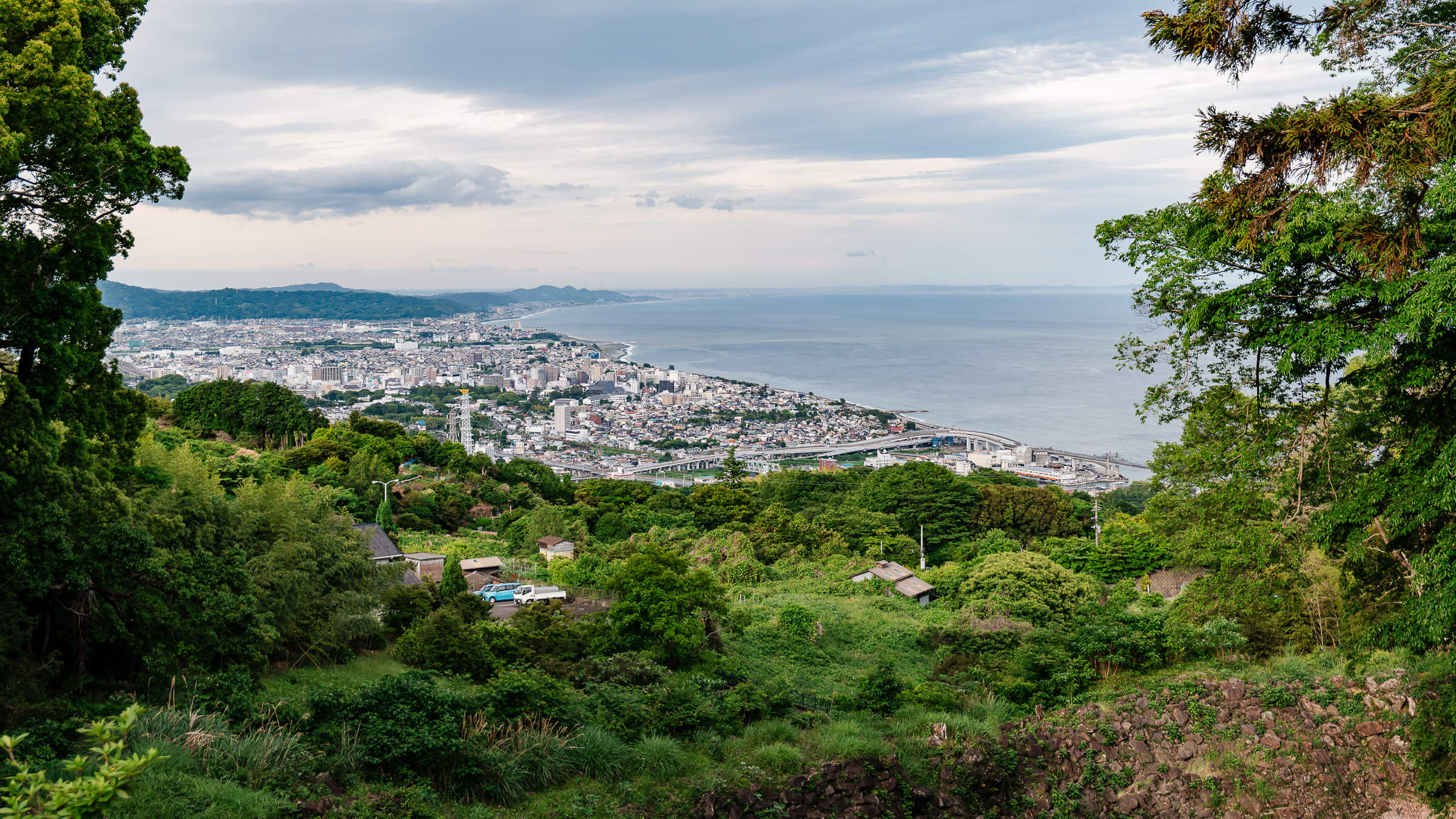
Further west, Odawara operates as a structural hinge between coast and highland. From here, movement branches toward Hakone or into the Ashigara hills.
Hakone forms a contained volcanic basin organized around Lake Ashi, Owakudani, the Hakone Ropeway, and interconnected transport loops. It marks the geographic transition toward the Mount Fuji region.
North of Odawara, forested valleys lead to Daiyuzan Saijoji Temple in the Ashigara highlands. Beyond this, the Tanzawa mountain system extends across Yamakita, Hadano, and Isehara. Sustained elevation gain defines movement in this zone. Peaks such as Mount Omuro and Mount Oyama represent the prefecture’s interior vertical terrain.
Coastal travel operates rail-first. Inland areas increasingly require bus connections or car access to reach dispersed mountain routes.
Kanagawa Prefecture connects metropolitan Tokyo to coastline, basin, and mountain within one administrative boundary. Understanding how these zones shift—from bay to temple corridor to volcanic basin to ridgeline—clarifies how Kanagawa functions within broader Kanto and Fuji-region movement.
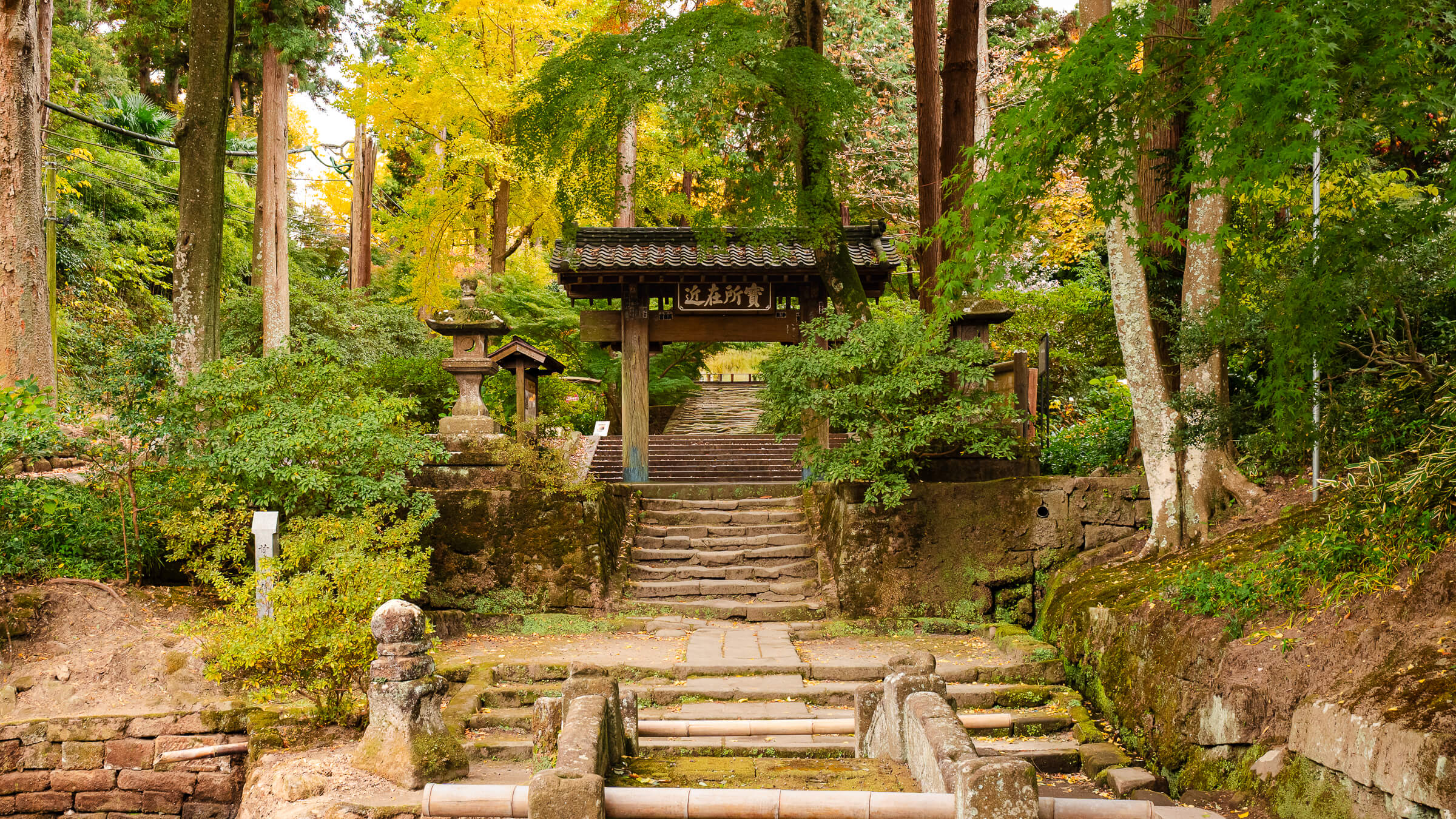
Why Visit Jōchi-ji Temple Jōchi-ji Temple is a Zen temple in Kita-Kamakura, located a short walk from Kita-Kamakura Station and close to Meigetsu-in, Kenchō-ji, Engaku-ji, and Tōkei-ji. It works well…
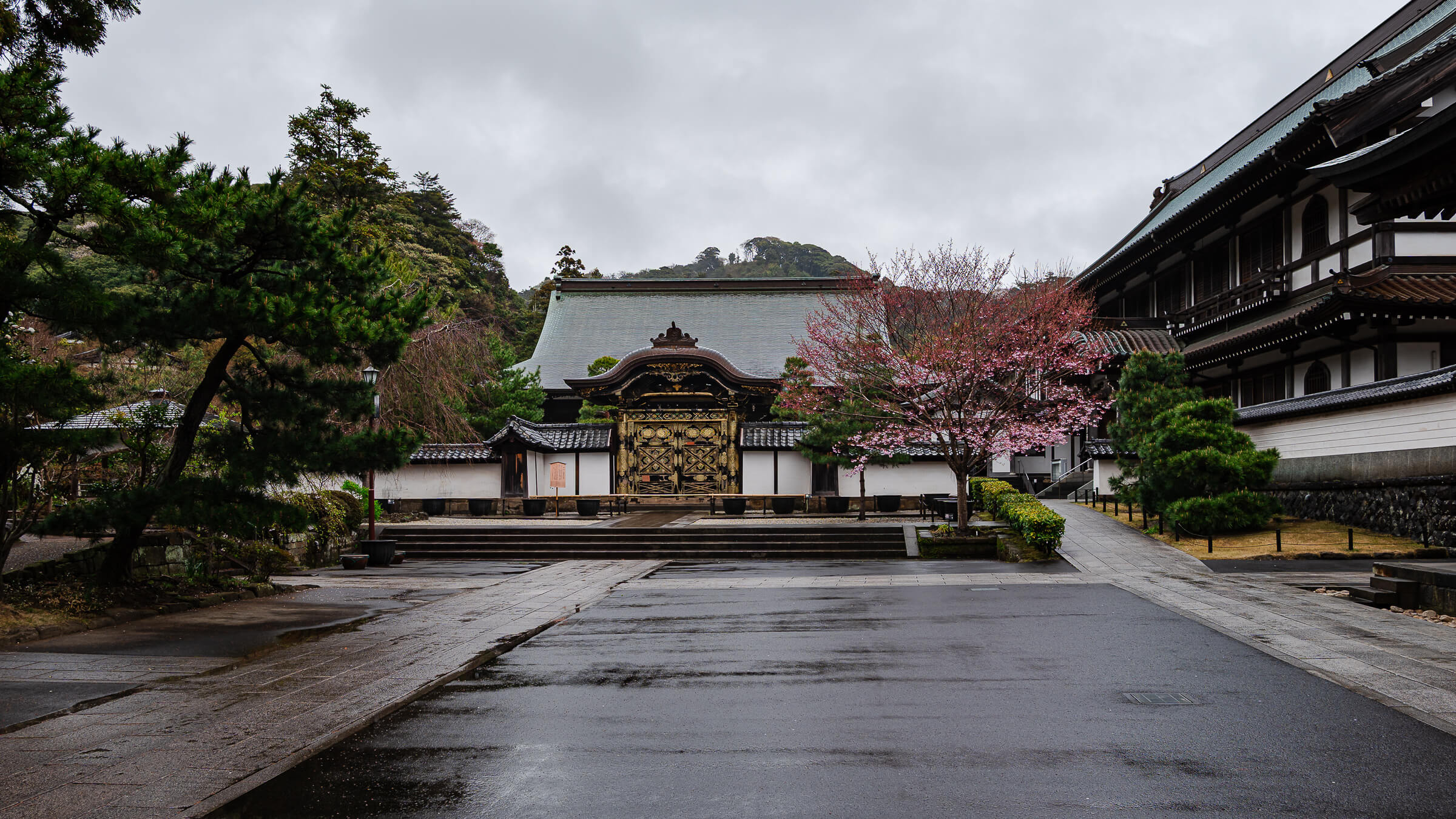
Japan's Oldest Zen Training Monastery Kencho-ji Temple stands at the southern end of Kita-Kamakura, where wooded hills rise above one of Kamakura's most historic districts. Founded in 1253 under the…
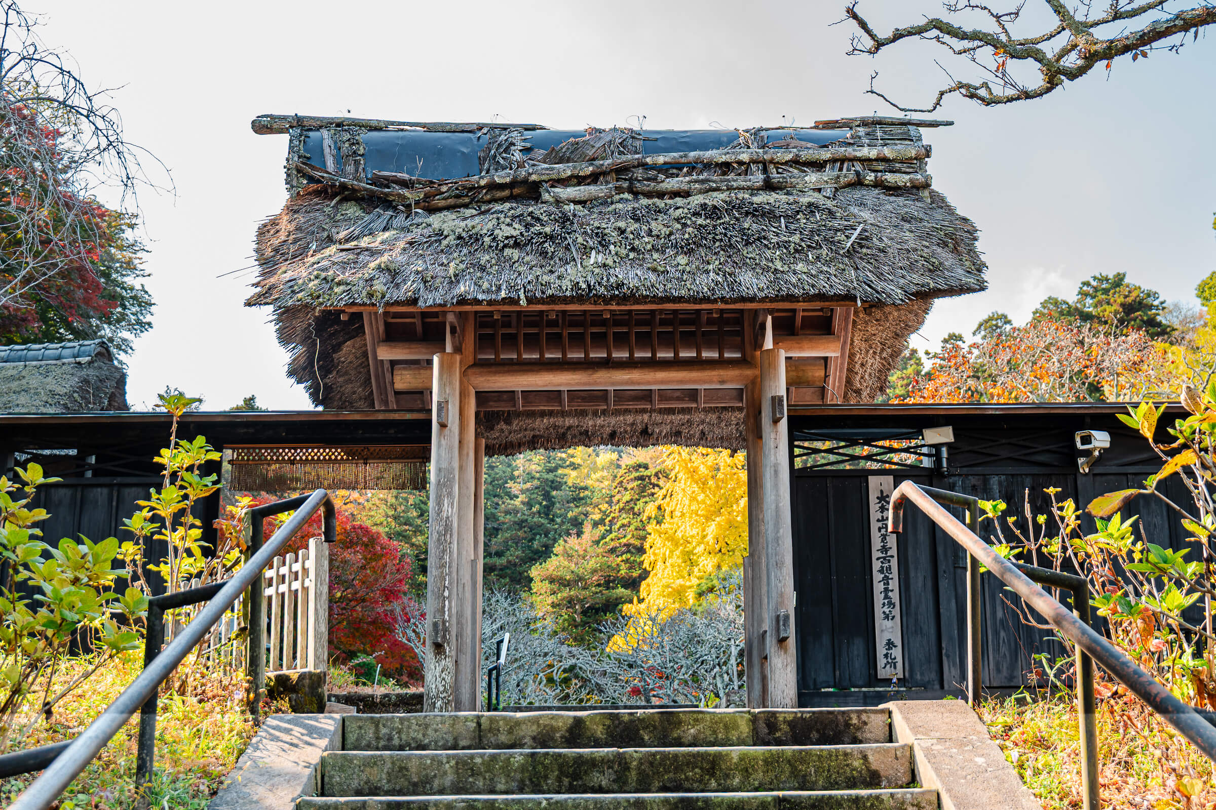
One of Kamakura's Most Unusual Temple Histories Tokei-ji Temple (東慶寺) occupies a distinctive place among Kamakura's many temples. Located in Kita-Kamakura near Engaku-ji and Jochi-ji, the temple combines centuries of…
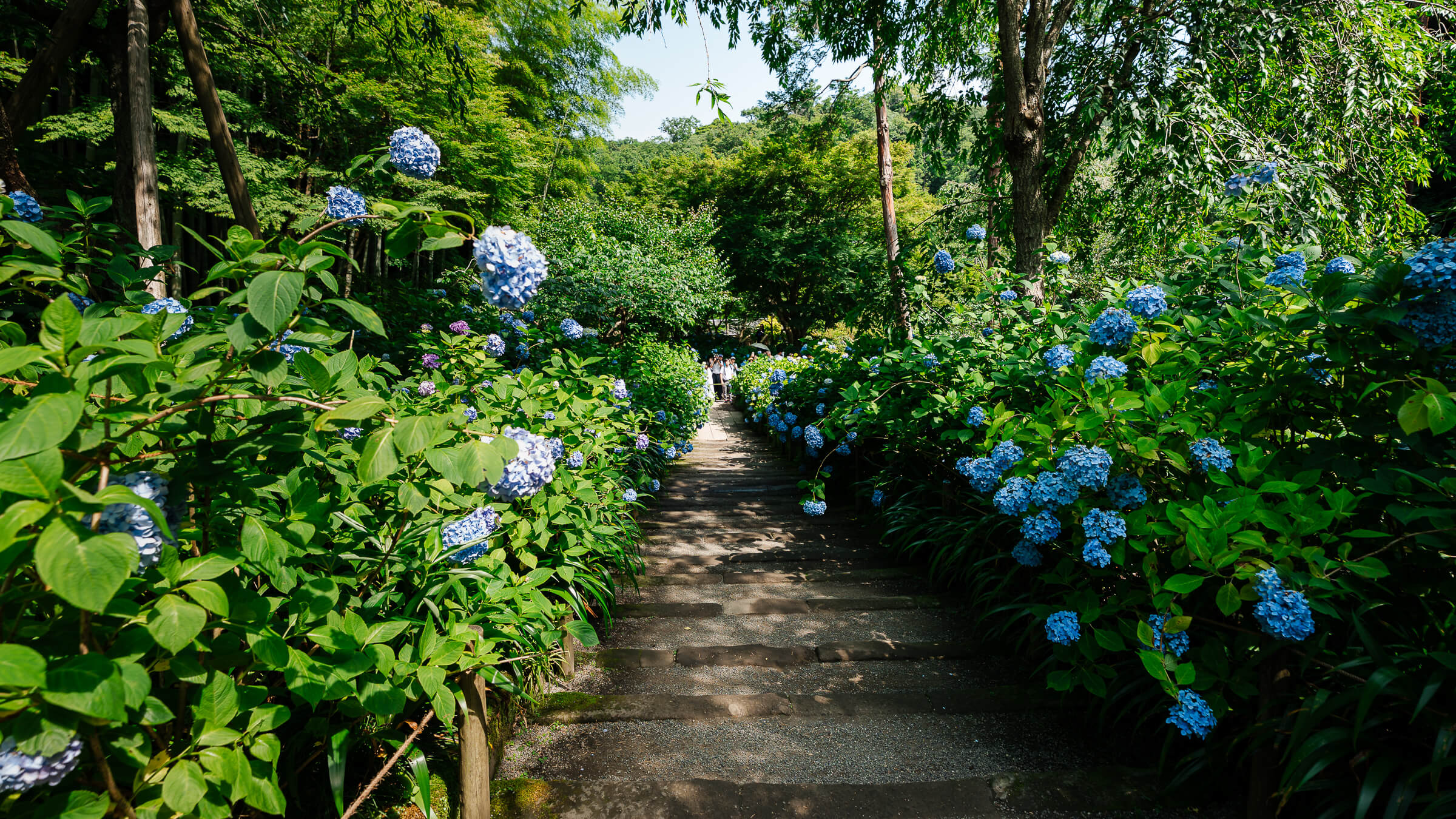
A Temple Walk Shaped by Blue Hydrangeas Meigetsu-in Temple sits in Kita-Kamakura, in Kamakura, Kanagawa Prefecture, about a short walk from Kita-Kamakura Station and within the same temple corridor as…
Why Odawara Is Harder to Place Than It First Appears Odawara sits in western Kanagawa between Tokyo, Hakone, Atami, and the coastal routes leading toward the Izu Peninsula. At first,…
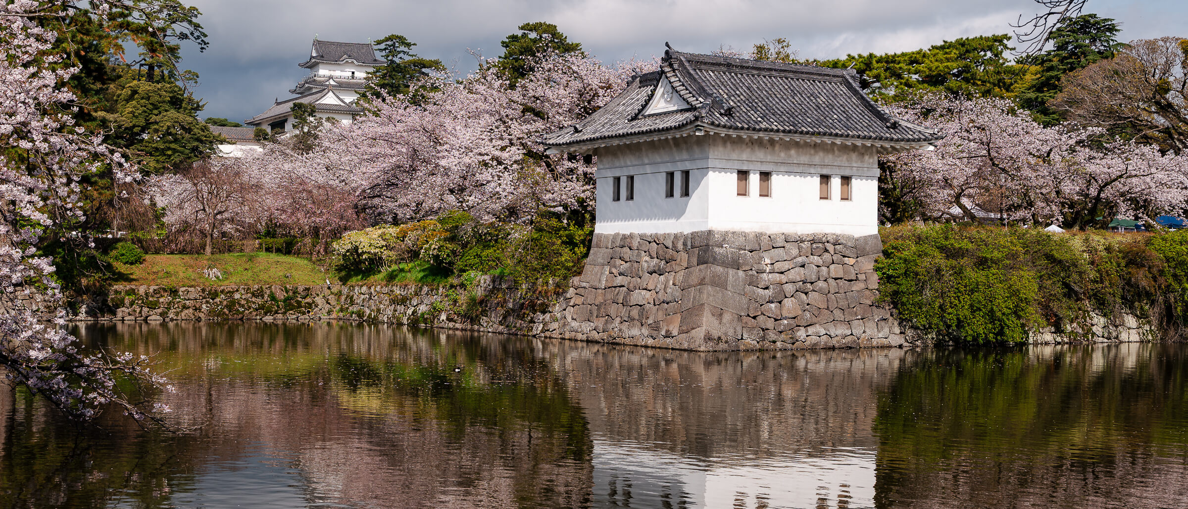
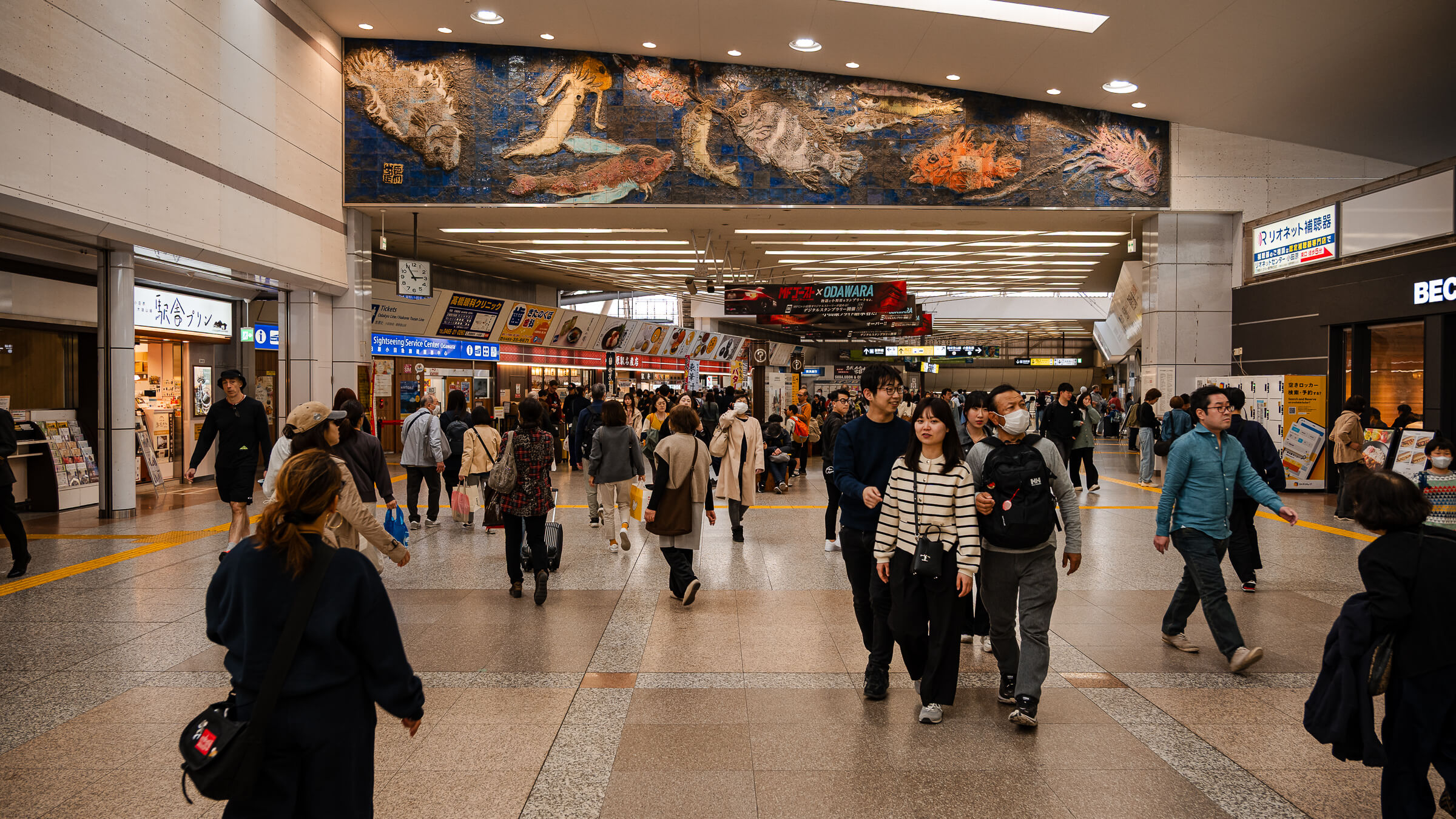
A Station That Shapes How Western Kanagawa Unfolds Odawara Station sits only a short walk from Odawara Castle, where castle grounds, shopping streets, museums, and regional rail lines overlap within…
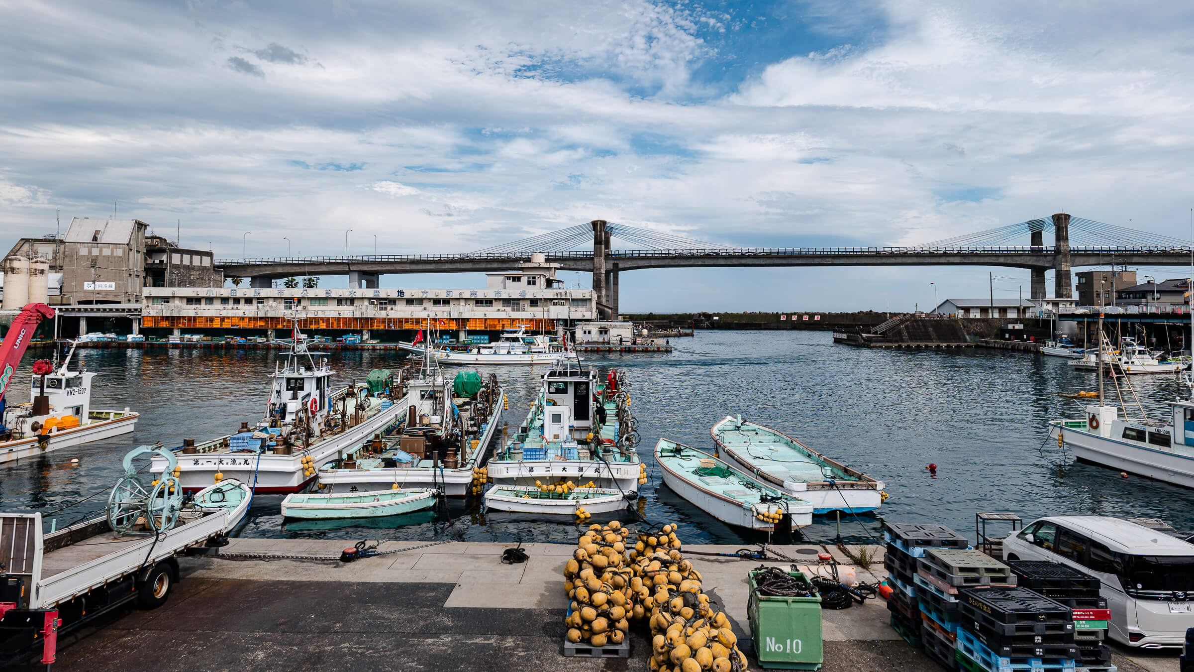
A Small Port That Opens Up as You Walk Toward the Water Odawara Fishing Port (Hayakawa) sits one stop from Odawara Station at Hayakawa, within Kanagawa Prefecture along the coastal…
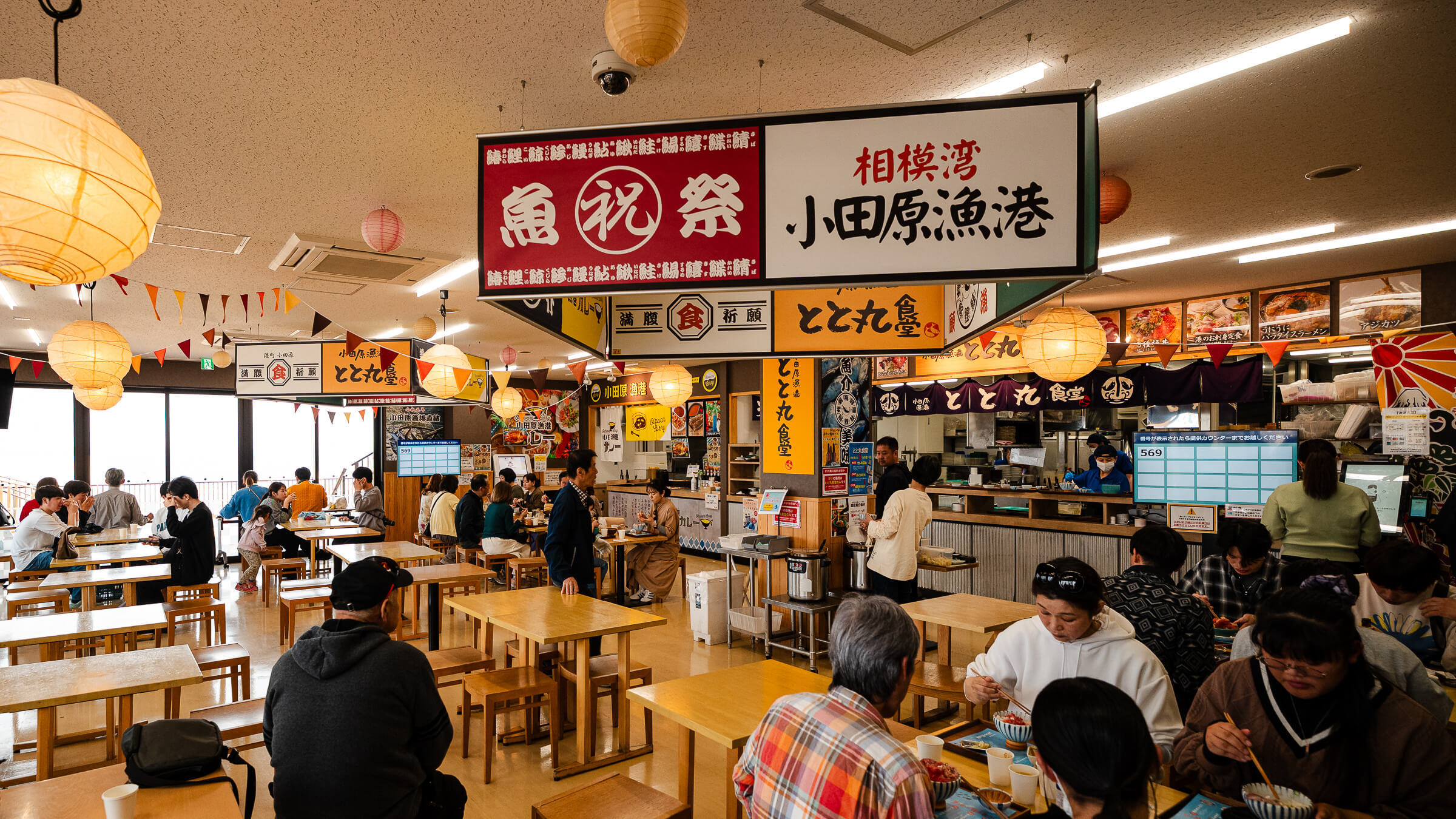
A Coastal Stop That Only Makes Sense Midway Through the Day TOTOCO Odawara sits along the coastal edge of Odawara in Kanagawa Prefecture, positioned between Odawara Castle and the fishing…
Seeing Odawara From Above Changes How the City Reads Ishigakiyama Castle Ruins sit on a wooded ridge above Odawara, just inland from the coastal plain and west of Odawara Castle.…
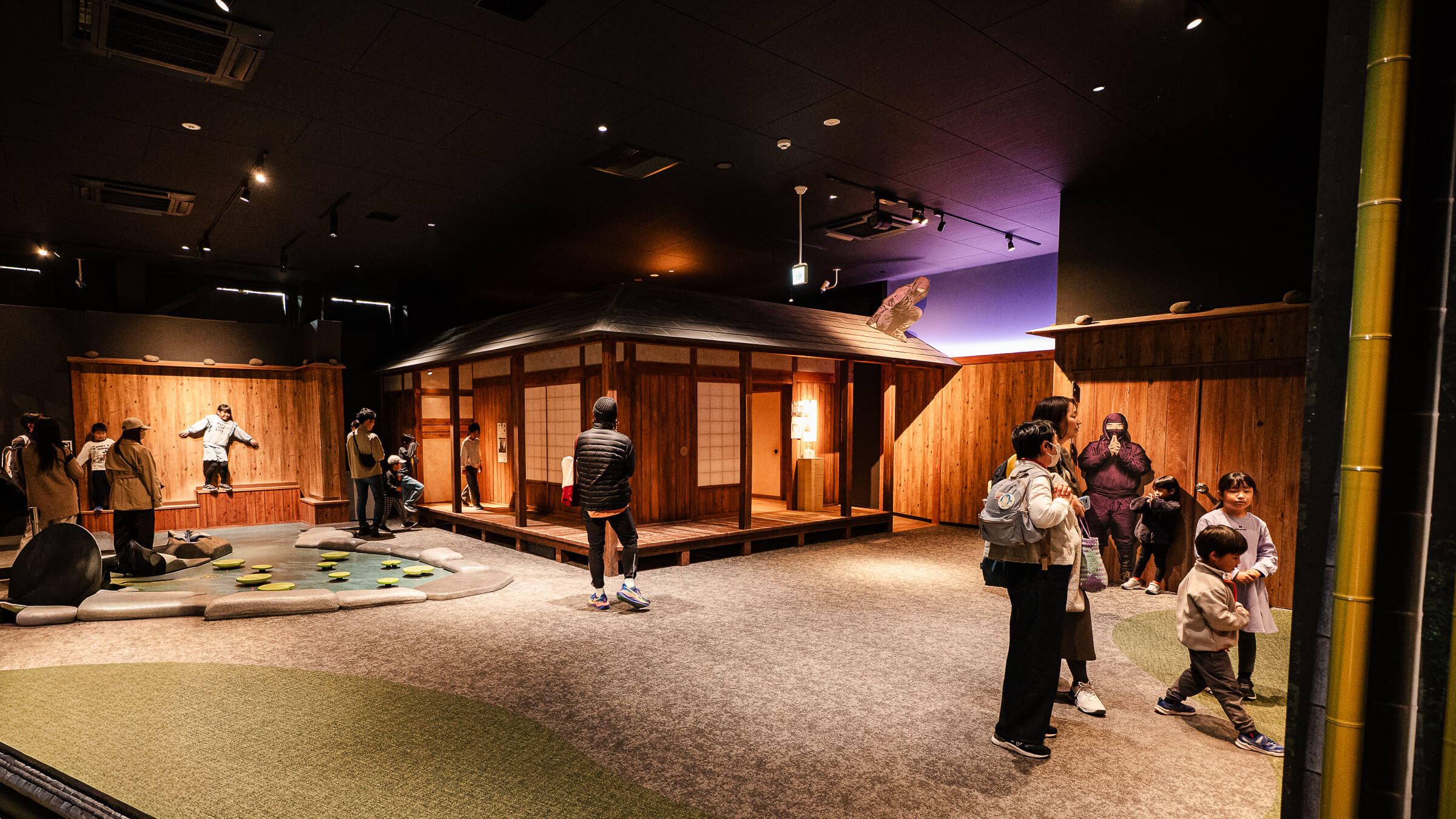
Set in the Lower Courtyard Before the Main Grounds The Odawara Castle Ninja Museum sits within the lower courtyard of Odawara Castle in Odawara, a coastal city in Kanagawa Prefecture…