Mount Oyama from Minoge: A Quiet Path Through Ancient Pilgrimage History
A Different Way Most People Don’t Start Most visits to Mt. Oyama begin near the shrine side, using the Omotesandō steps or the cable car to shorten the climb. That…
Kanagawa Prefecture sits directly south of Tokyo in the Kanto region. It forms the geographic bridge between the capital and the Fuji corridor of Shizuoka and Yamanashi. Tokyo Bay defines its eastern edge. Sagami Bay shapes the southern coastline. The Tanzawa Mountains rise across the northwest.
This compact prefecture compresses port cities, temple districts, coastal rail towns, volcanic highlands, and interior ridgelines within a short travel span. Elevation increases steadily as you move west. Rail density thins. Terrain becomes more vertical. The transition from metropolitan corridor to mountain system happens within roughly one to two hours.
Along Tokyo Bay, Yokohama and Kawasaki form a continuous urban belt connected directly to Tokyo’s rail network. Movement here is infrastructure-driven and dense.
South of this corridor, Kamakura anchors the coastal historic zone. Its core landmarks include Tsurugaoka Hachimangu, Hasedera Temple, and Kotoku-in (Daibutsu). Komachi Street runs between the station and shrine complex, forming the central pedestrian corridor. Surrounding wooded hills contain established hiking courses such as the Daibutsu Trail and Tenen Course, linking temple districts through ridgeline paths. West of Kamakura, the Shonan coast extends through Enoshima, Fujisawa, and Hiratsuka with rail lines running parallel to Sagami Bay.
Further west, Odawara operates as a structural hinge between coast and highland. From here, movement branches toward Hakone or into the Ashigara hills.
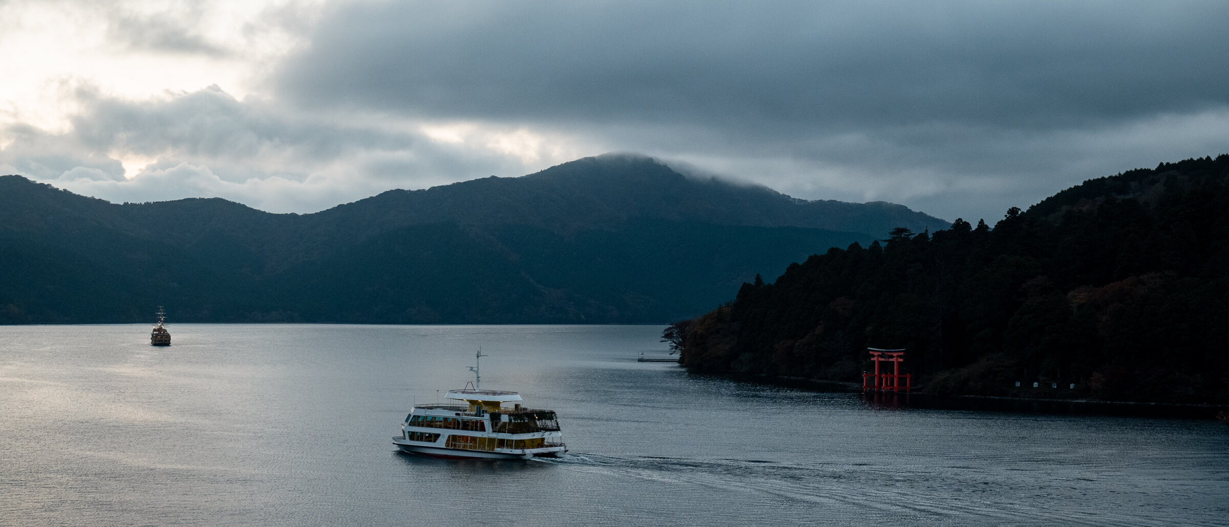
Hakone forms a contained volcanic basin organized around Lake Ashi, Owakudani, the Hakone Ropeway, and interconnected transport loops. It marks the geographic transition toward the Mount Fuji region.
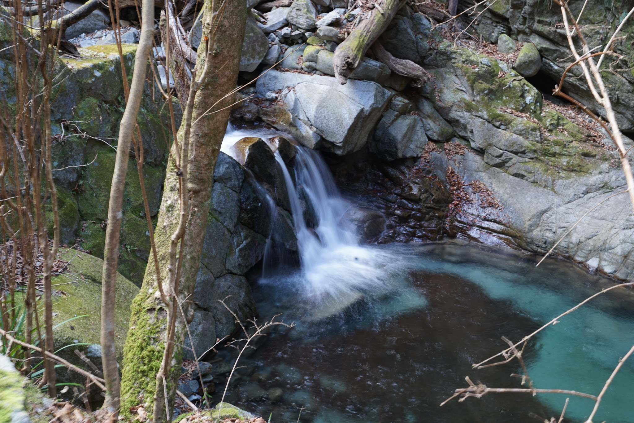
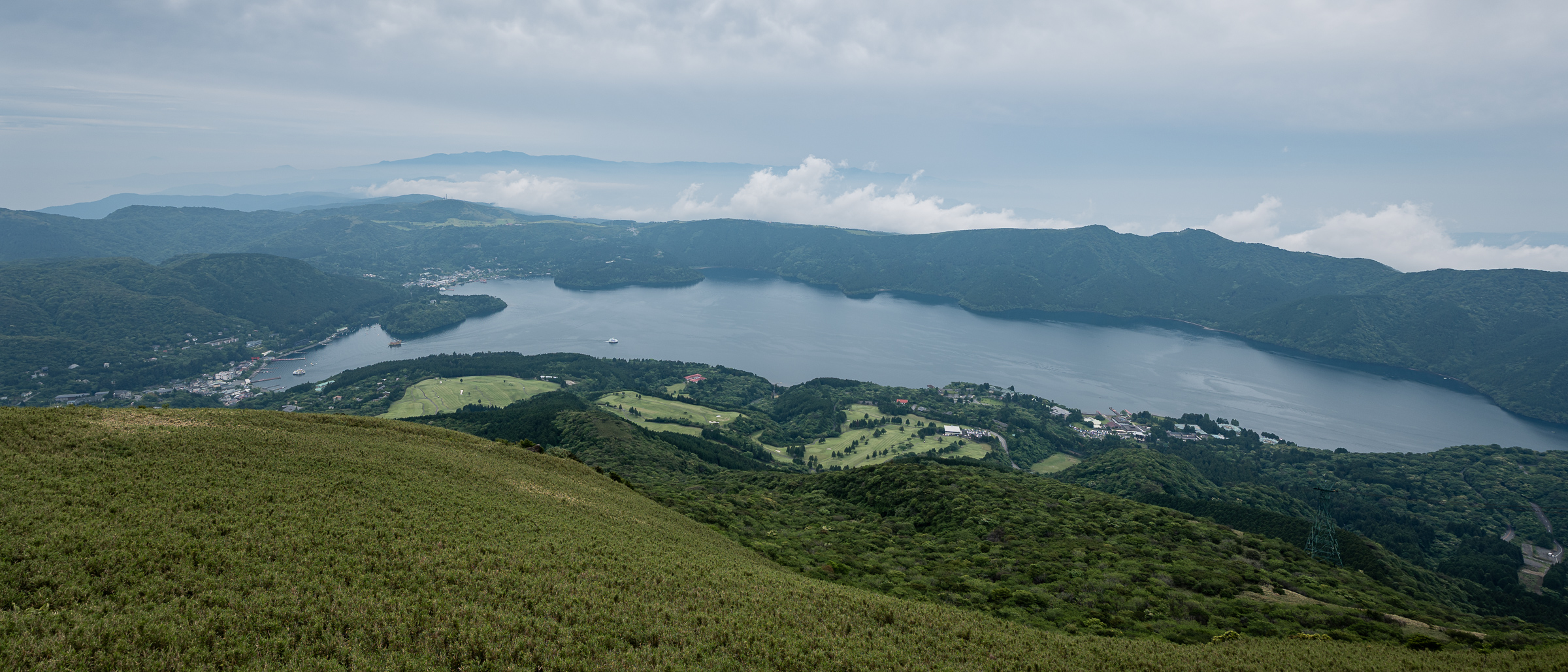
North of Odawara, forested valleys lead to Daiyuzan Saijoji Temple in the Ashigara highlands. Beyond this, the Tanzawa mountain system extends across Yamakita, Hadano, and Isehara. Sustained elevation gain defines movement in this zone. Peaks such as Mount Omuro represent the prefecture’s interior vertical terrain.
Coastal travel operates rail-first. Inland areas increasingly require bus connections or car access to reach dispersed mountain routes.
Kanagawa Prefecture connects metropolitan Tokyo to coastline, basin, and mountain within one administrative boundary. Understanding how these zones shift—from bay to temple corridor to volcanic basin to ridgeline—clarifies how Kanagawa functions within broader Kanto and Fuji-region movement.
A Different Way Most People Don’t Start Most visits to Mt. Oyama begin near the shrine side, using the Omotesandō steps or the cable car to shorten the climb. That…
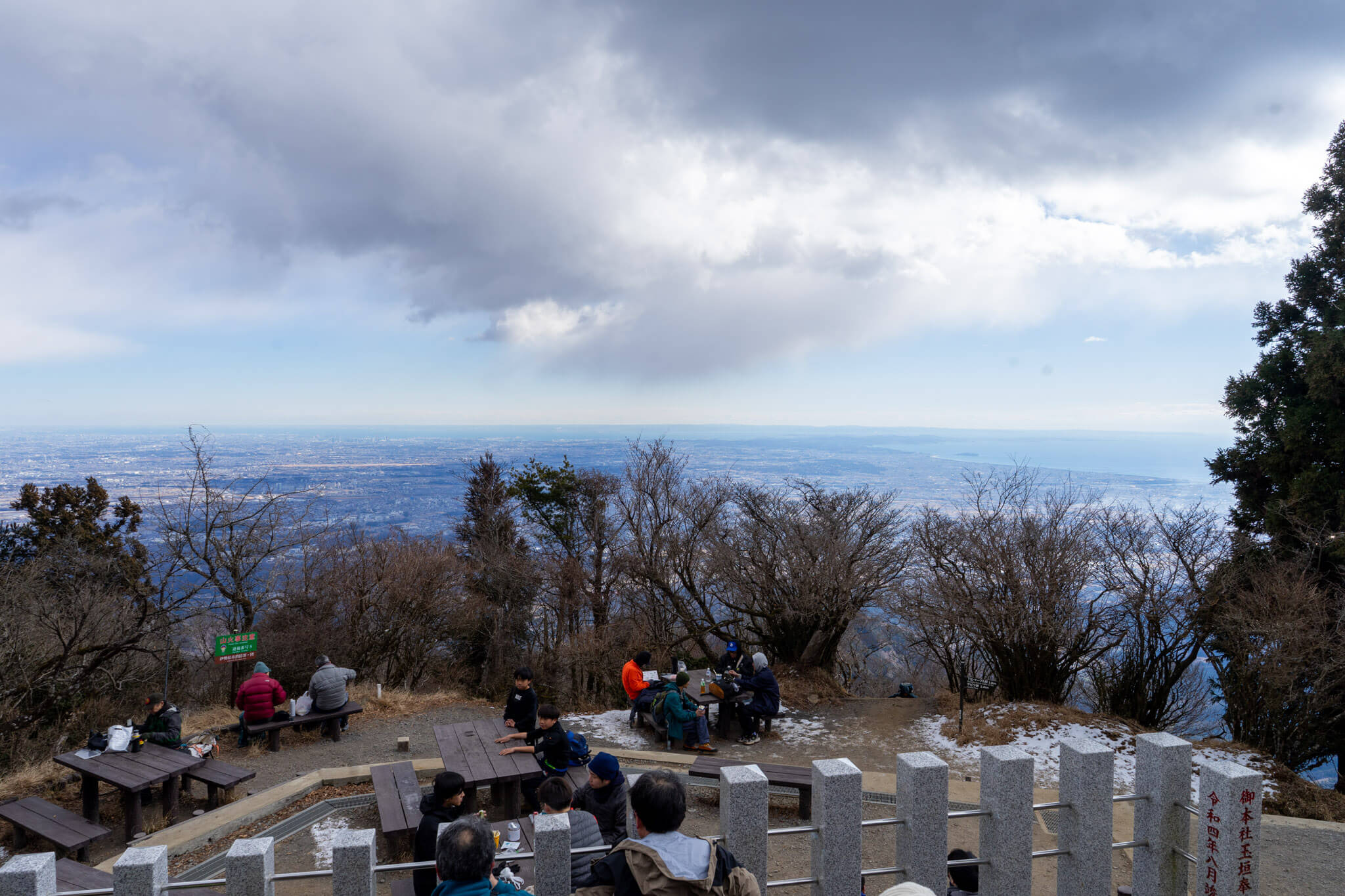
Mt. Omuro rises deep within the western side of the Tanzawa mountain range, beyond the better-known trailheads and day-hiking routes that draw visitors toward Hakone. At 1,588 meters, it is…
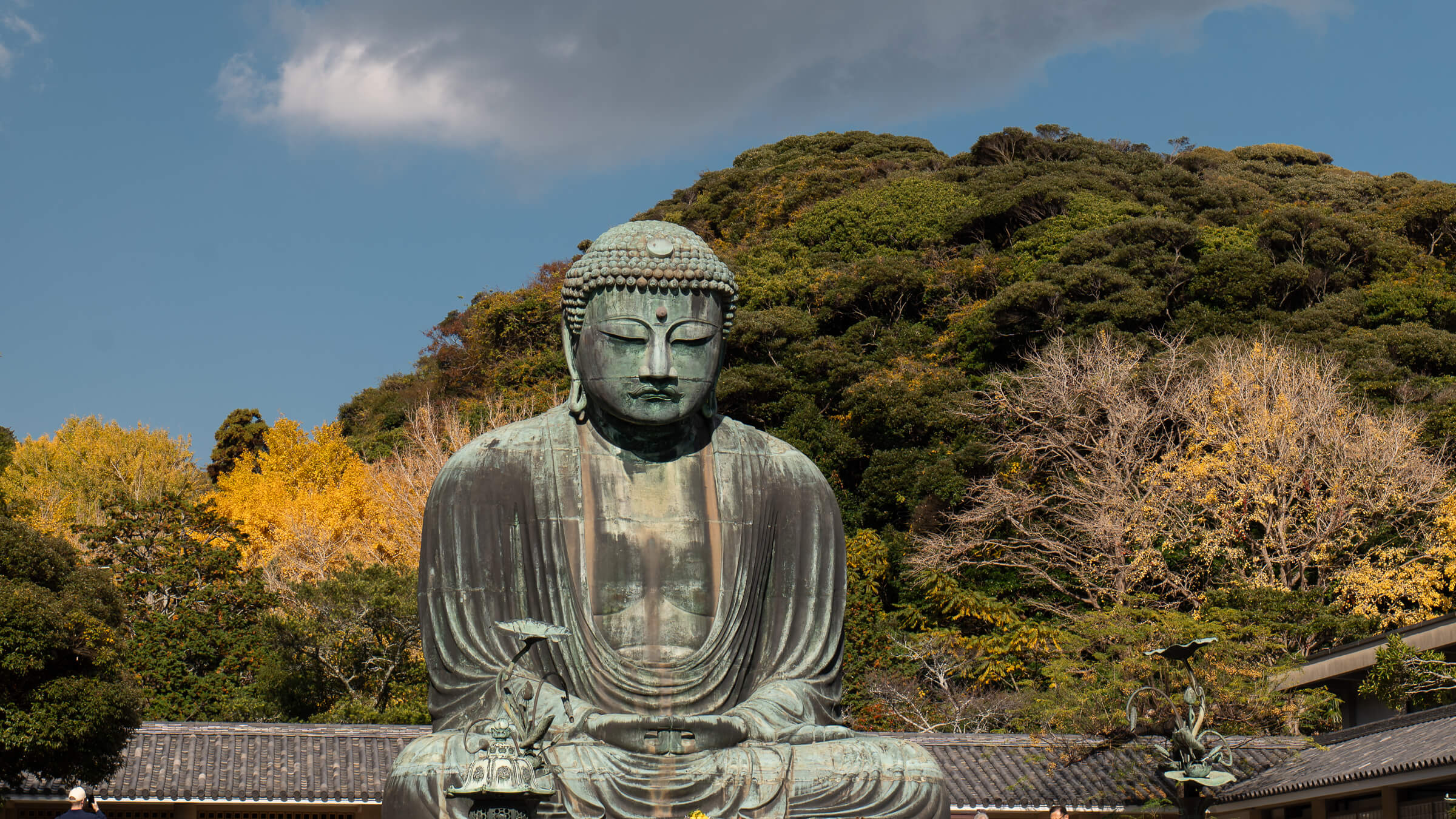
The Setting Kōtoku-in Temple is one of Kamakura’s shortest and most contained visits, built entirely around a single encounter with the Great Buddha. There is no long approach or layered…
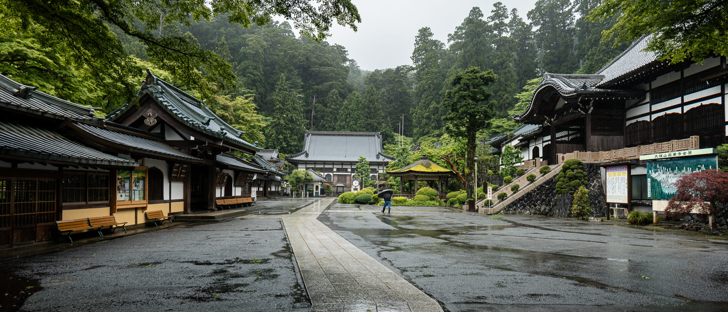
The first impression Daiyuzan Saijoji sits where western Kanagawa becomes forested and mountainous, on the outer edge of the Hakone area. Whether you arrive from the visitor approach or step…
What this museum is Narukawa Art Museum sits on the hillside above Moto-Hakone, overlooking Lake Ashi. It is a private museum devoted to modern nihonga—Japanese-style painting—set in a position where…
What this place is and why people come Hakone Komagatake Ropeway is a short cable car ride that lifts visitors from the shore of Lake Ashi to the summit of…
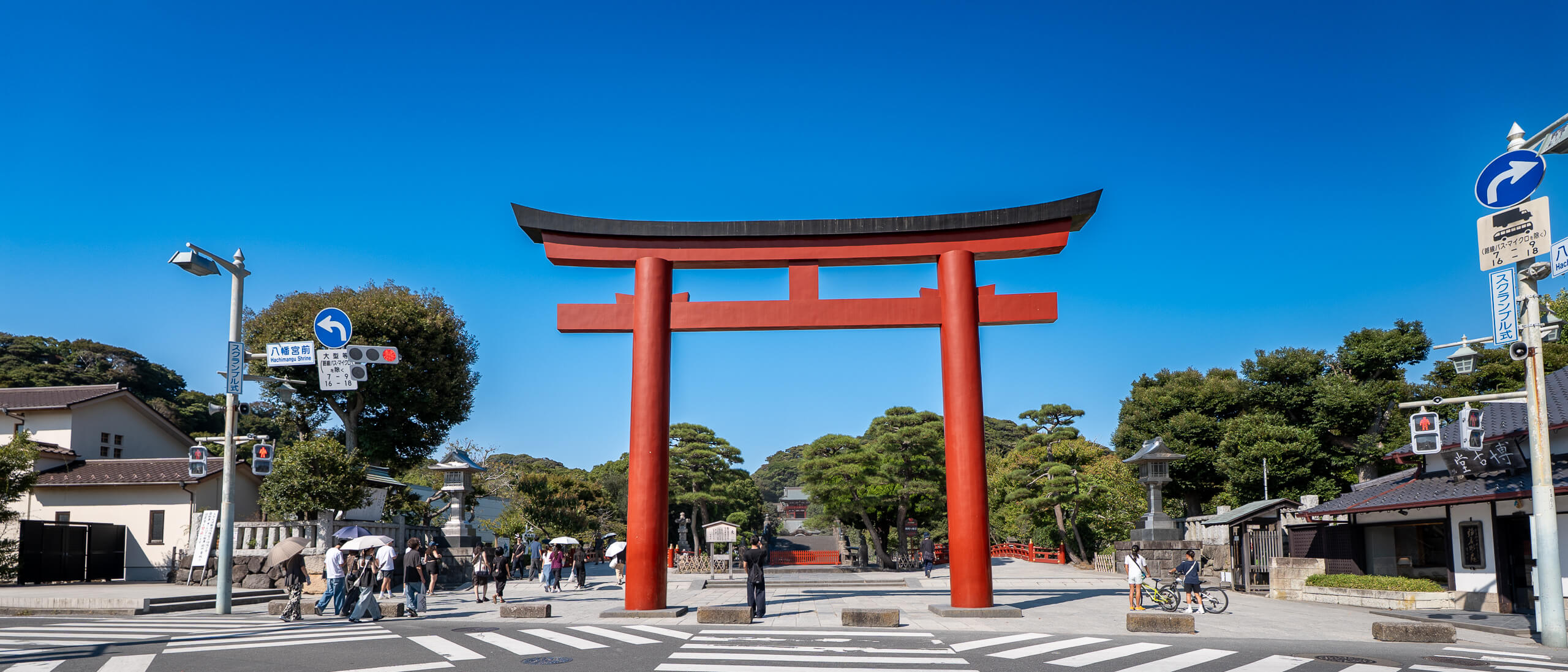
Tsurugaoka Hachimangū is Kamakura’s most important Shinto shrine and the spiritual anchor of the old samurai capital. Most visitors start from Kamakura Station, where you have two good options: follow…
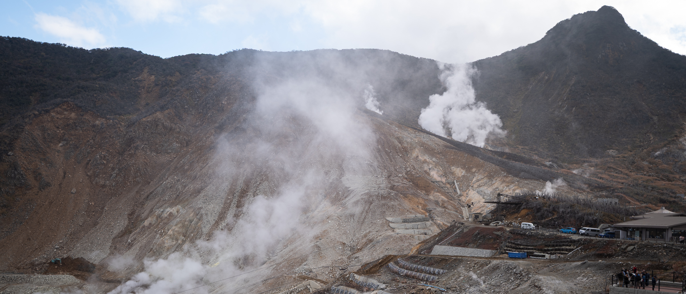
What to Expect Owakudani is an exposed volcanic valley where sulfur vents release steam across a broad, open mountainside. The experience is visual rather than immersive: wide views, visible geothermal…
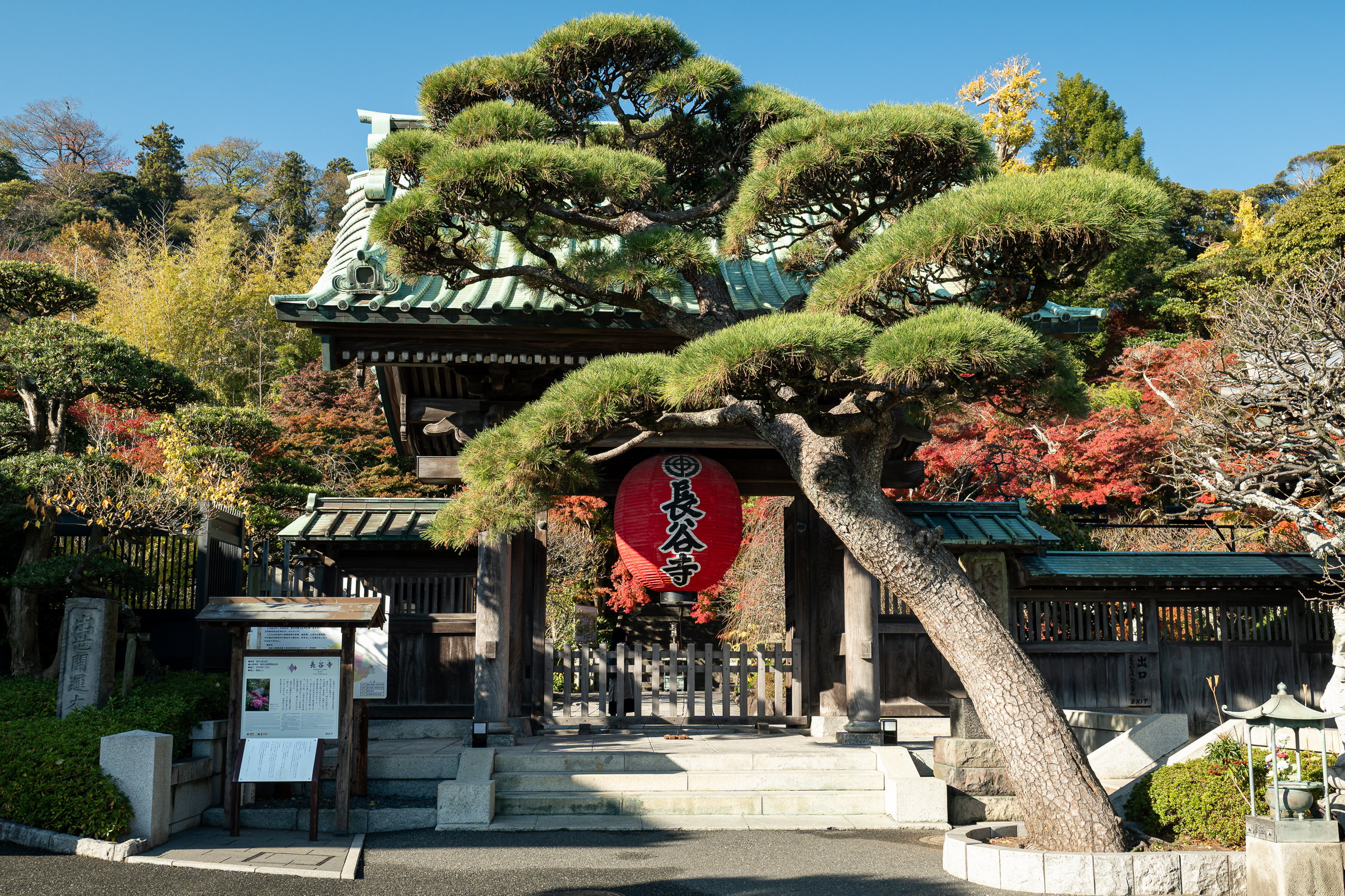
Overview Hase-dera Temple sits on Kamakura’s western side in the Hase district, a short walk from Kōtoku-in, home of the Great Buddha. From Kamakura Station and Komachi Street, it’s about…