
Perched on the rugged border between Yamagata and Akita Prefectures, Mount Chōkai (鳥海山, Chōkai-san) rises sharply from the Sea of Japan, forming a dramatic landmark known for centuries as “Dewa Fuji” — a reference to its graceful, Fuji-like silhouette. Standing at 2,236 meters (7,336 feet), it is Yamagata’s highest peak and one of Tohoku’s most iconic mountains.
A Mountain of Spirit and Tradition
For centuries, Mount Chōkai has been a place where everyday life brushes up against the divine. Pilgrims once climbed its flanks as part of Shugendō mountain practice, seeking purification in wind, cloud and snow. Shrines around the base still echo that history; stone markers and weathered torii quietly remind you that the mountain was a training ground long before it became a hiking destination.
Even today, Chōkai feels different from many famous peaks closer to Tokyo. Trails are quieter, conversations are softer, and the atmosphere leans more toward reflection than conquest. You notice it in the way hikers greet each other, in the small offerings of coins and bells at summit shrines, and in the simple joy people take in seeing the Sea of Japan far below.
If you’re drawn to mountains not just for views but for the sense of story they carry, Chōkai rewards you slowly. It invites you to walk at your own pace, to sit on the rocks near the summit shrine, and to let the landscape sink in—a mix of volcanic ridges, wind-combed grass and clouds drifting across Tohoku’s broad horizon.
Trail Options on Mt. Chokaisan
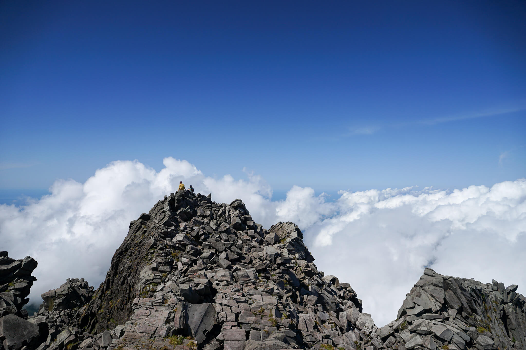
Most hikers treat Chōkai as a full-day summer ascent. Classic routes weave through alpine wetlands, volcanic ridges and scattered snowfields that can linger well into July. Trails are generally well-marked, but distances add up quickly, and much of the walking is exposed—this is a mountain that deserves an early start and a realistic turnaround time.
Popular approaches begin from highline roads and trailheads that cut some of the vertical gain, turning the climb into a demanding but achievable day for fit hikers. Expect long, steady sections of ascent punctuated by rocky steps, short scrambles and moments where the view suddenly opens and you realize how far you’ve climbed above the plains.
If a full summit push isn’t your goal, you still have options. Shorter walks to mid-level viewpoints, boardwalk loops through marshes, and gentle ridge strolls let you taste Chōkai’s scenery without committing to a full-day effort. On clear days, even these “easier” routes deliver big-sky views over rice fields, coastline and distant ranges.
Seasons and Weather
Chōkai is very much a summer and early-autumn mountain. Heavy snowpack and lingering drifts keep higher trails closed or challenging well into June, and winter conditions are strictly for experienced mountaineers with proper gear and avalanche awareness.
From mid-July through September, trails are usually clear, flowers and alpine plants are at their peak, and daylight hours are generous. Afternoons, however, can bring quick-moving mists and sudden weather changes off the Sea of Japan. A day that starts in bright sun can turn cool and cloudy in minutes, so extra layers, gloves and a good rain shell are essential even in August.
In late September and early October, the air turns crisp and the first autumn colors brush the slopes. Views can be spectacular on clear days, but temperatures drop quickly once the sun dips and the first frosts aren’t far behind. Always check local forecasts, watch the cloud build-up, and give yourself enough margin to descend safely before weather or light becomes an issue.
Access and Trailheads
Mt. Chōkai sits on the border of Yamagata and Akita, and access usually starts from coastal towns and rural stations along the Sea of Japan side. In practice, most visitors either drive to a trailhead or combine train + local bus or taxi up to one of the highline roads.
From larger hubs like Sakata or Yuza, local buses and seasonal services run toward Chōkai during the main hiking period, often connecting with trailheads near mountain lodges, parking areas or visitor centers. Schedules, however, change from year to year, and services may be limited outside weekends and peak season. If you’re relying on public transport, it’s worth checking the most recent timetable in advance and planning your return carefully.
If you’re driving, mountain roads are typically open only in snow-free months and may close temporarily in bad weather. Parking is usually concentrated near trailheads, with basic toilet facilities and information boards. As always in rural Tohoku, carry some cash, top up fuel earlier in the day, and don’t expect convenience stores at the top of the climb—the last chance for supplies is usually down on the plain.
Safety and Practical Tips
Chōkai is beautiful but serious terrain. Even on a calm day, distances, exposure and fast-changing weather demand respect. Think of it less as a quick tick on a list and more as a full-value mountain day.
• Start early. Many routes are long; giving yourself a first-light start means more time for breaks, photos and a relaxed descent.
• Pack for wind and cold. Temperatures at 2,000+ meters can feel like a different season compared to the coast. A warm layer, hat, gloves and rain gear are non-negotiable.
• Footwear matters. Trails mix dirt, stone steps and volcanic rock. Sturdy hiking shoes or boots with good grip make the day far more enjoyable.
• Carry water and snacks. Don’t assume you’ll find taps or huts on route. Treat Chōkai like a self-supported hike.
• Respect the shrines and markers. Many are still active places of worship. A quiet bow or simple “osoreirimasu” goes a long way.
Treat the mountain well—pack out your rubbish, keep voices low near shrines, and give yourself enough time to descend safely. In return, Chōkai gives you something rare: a big Tohoku peak that still feels genuinely wild and rooted in old beliefs.
Planning Your Tohoku Journey
Mt. Chōkaisan is one of those places that stays with you long after the hike is over—part summit, part shrine, part sea-view balcony over northern Japan. If you’re building a Tohoku itinerary, consider pairing this climb with coastal towns, onsen stays and slower days in the countryside. Japan Unfolded will keep sharing routes, local tips and quiet corners so you can shape a trip that fits the way you like to travel.