Izu Peninsula (伊豆半島)
The Izu Peninsula extends south from western Kanagawa into eastern Shizuoka Prefecture. It forms a mountainous volcanic landmass bordered by Sagami Bay to the east and Suruga Bay to the west. The peninsula narrows as it moves south, with coastal roads tracing cliffs, fishing towns, and small harbor basins along the Pacific coastline.
Izu sits along the coastal corridor connecting Tokyo, Hakone, and the Pacific coast of Shizuoka. The northern gateway begins near Odawara and transitions through Atami, where rail lines from Tokyo first reach the peninsula.
Geography of the Izu Peninsula
Unlike the flatter Kanto plain to the north, the Izu Peninsula is shaped by volcanic terrain and coastal curvature. Interior ridgelines form a central spine that separates the eastern and western shores. As a result, travel usually follows the coastline rather than crossing the peninsula directly.
This geography creates distinct coastal zones rather than a single continuous corridor.
Major Areas of the Peninsula
Northern Izu centers on Atami and Ito, where rail access from Tokyo remains strong. Cities in this area include coastal destinations and attractions such as Kinomiya Shrine and Atami Castle.
Further south, the peninsula transitions into the Amagi mountain highlands and the western coast near Dogashima and Toi. These areas feature rugged cliffs and open views across Suruga Bay. The southern end of the peninsula centers on Shimoda, where the coastline widens and beaches become more common.
Movement Through Izu
Rail service runs primarily down the eastern side of the peninsula through Atami, Ito, and Shimoda. The western coastline becomes increasingly car-advantaged because the central mountain spine limits direct cross-peninsula routes.
Within Shizuoka Prefecture, the Izu Peninsula forms the eastern coastal corridor connecting Hakone with the Pacific towns of Shizuoka.
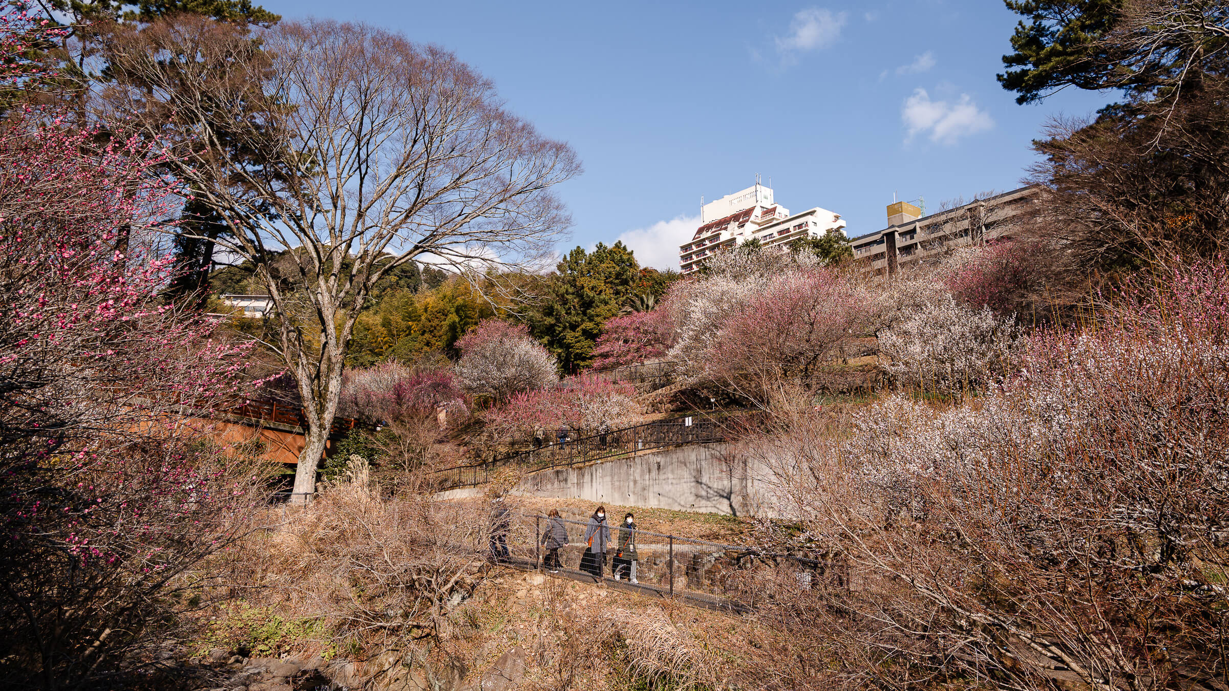
The Stream Valley Where Plum Trees Climb the Hillside Atami Plum Garden occupies a narrow hillside valley above the Kinomiya district of Atami, a short distance inland from the waterfront…
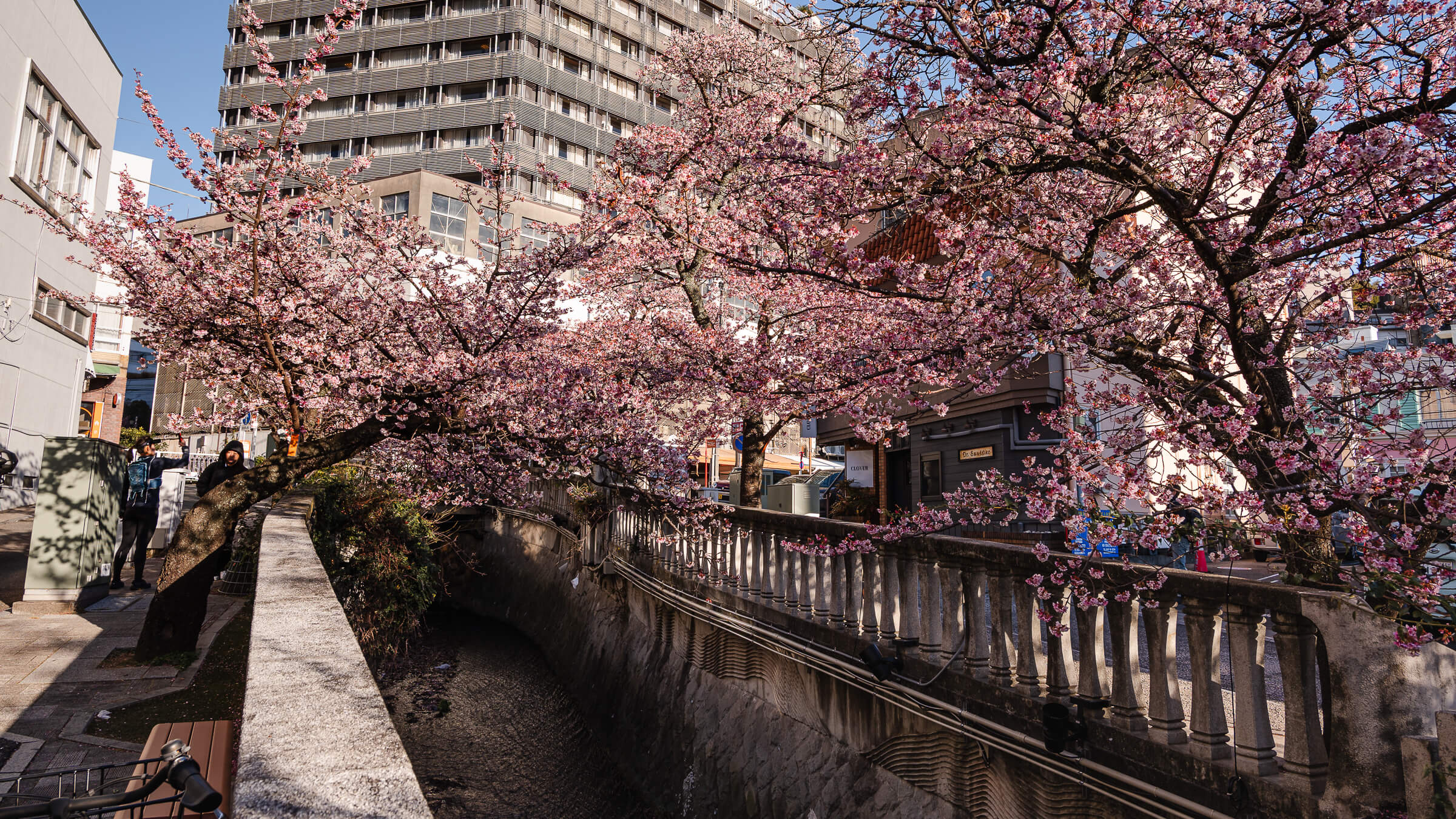
A Riverside Walk Running Through the Center of Atami The Itokawa Promenade follows a narrow river through the middle of Atami, linking the inland streets near the station with the…
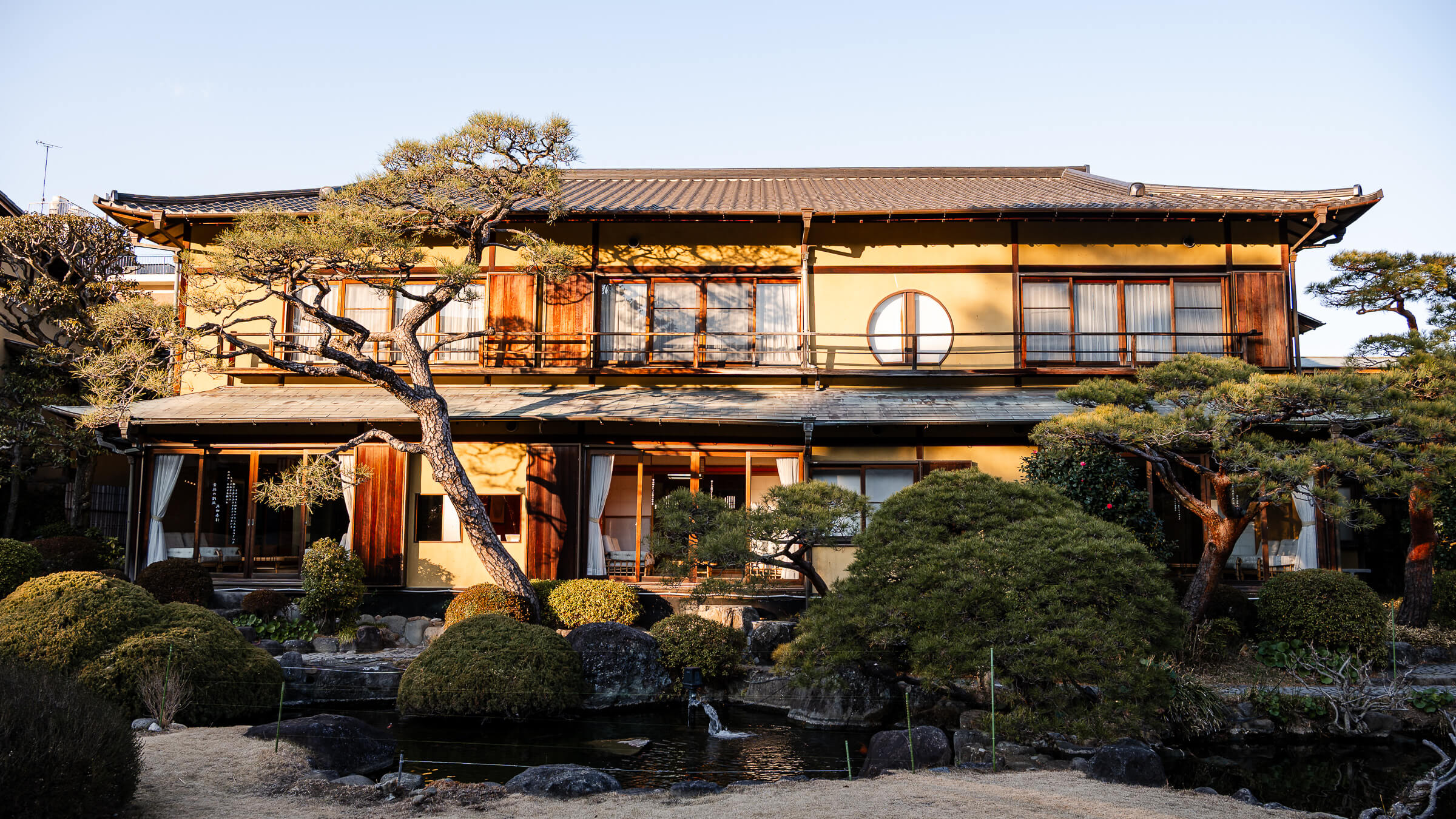
A Historic Villa Between Atami Station and the Waterfront Kiunkaku sits slightly inland from the waterfront in central Atami, between the station district and the coastal promenade near Atami Sun…
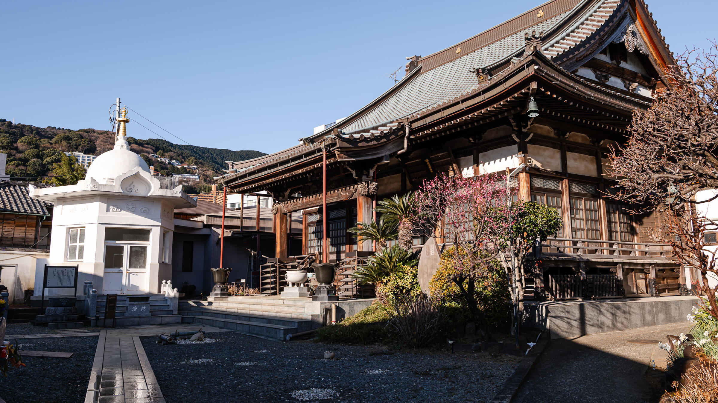
A Temple Positioned Between Station and Sea Seigon-in Temple sits on the slope below Atami Station, in the middle elevation band between the station district and the waterfront near Atami…
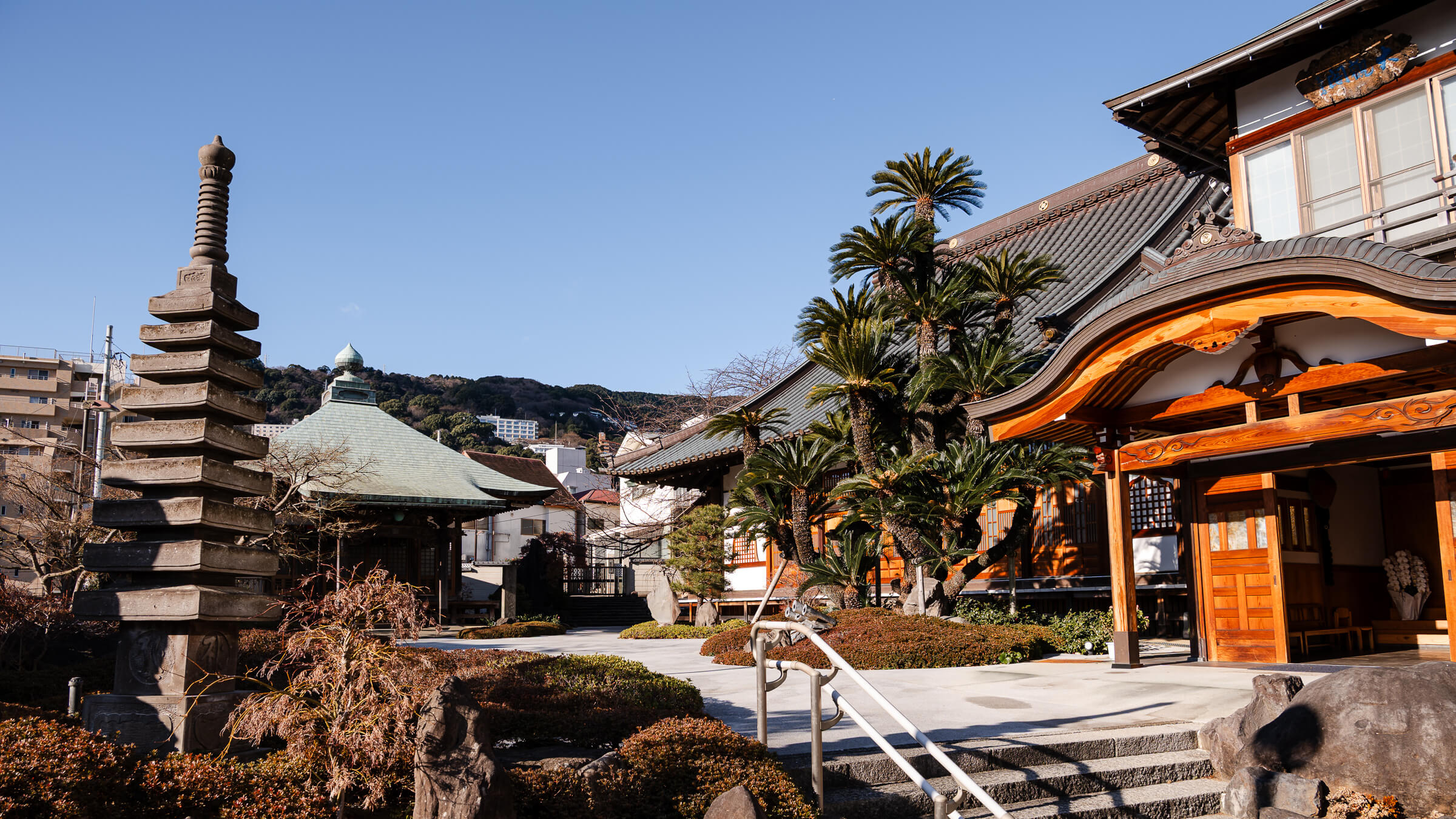
A Hillside Stop in Atami, Shizuoka Onsen-ji Temple occupies the middle slope of Atami, a coastal city in eastern Shizuoka Prefecture. It sits between Atami Station and the waterfront near…
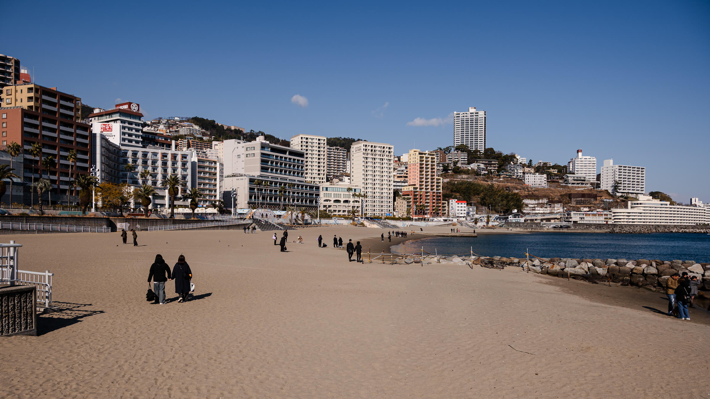
The Shape of the Bay Atami Sun Beach forms a broad arc along Atami Bay, creating a continuous stretch of sand directly in front of the city. In a town…
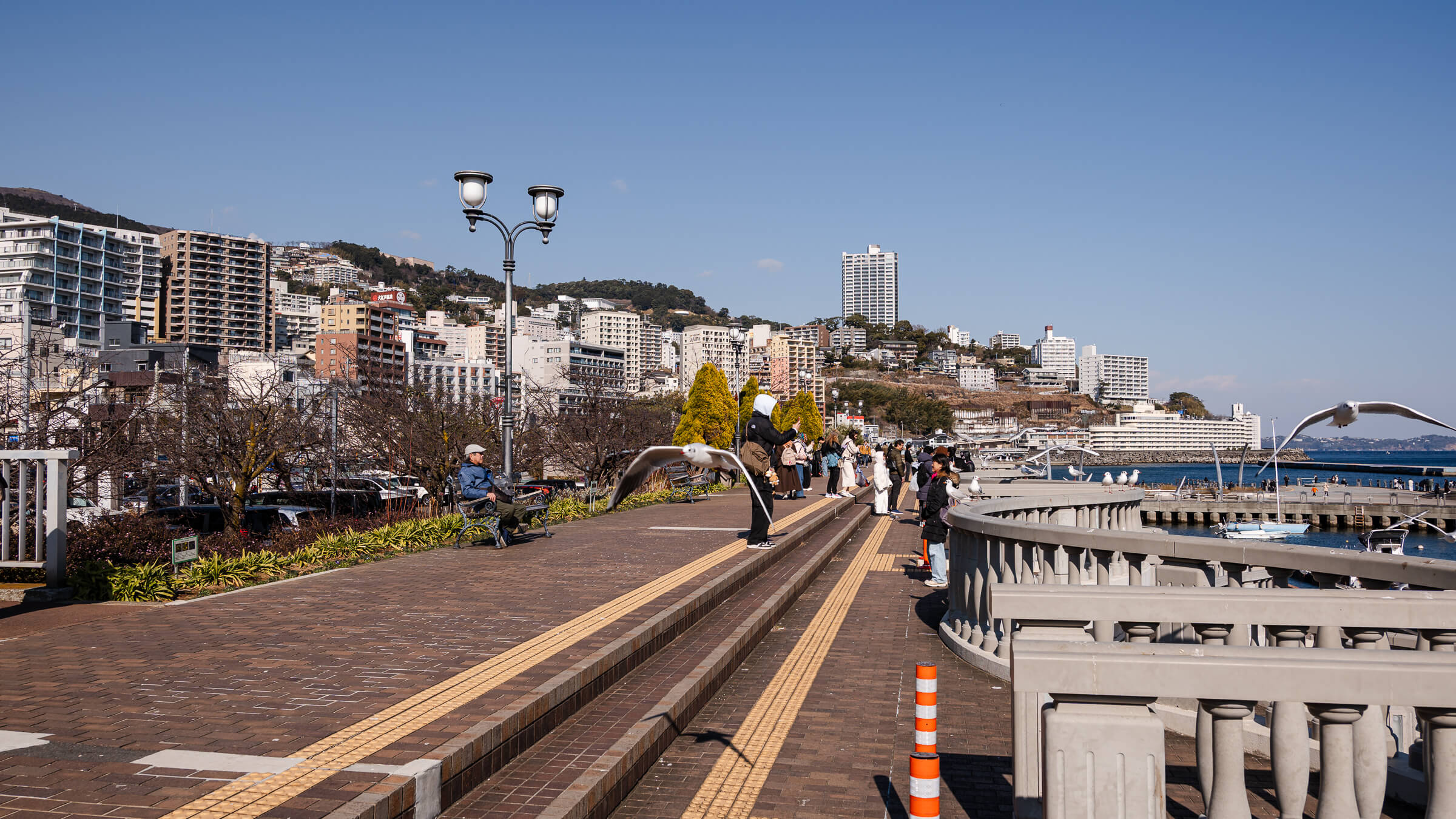
Where the Promenade Opens Atami Water Park marks the point where the sand of Atami Sun Beach transitions into a structured harbor front. Many walking routes in Atami descend gradually…
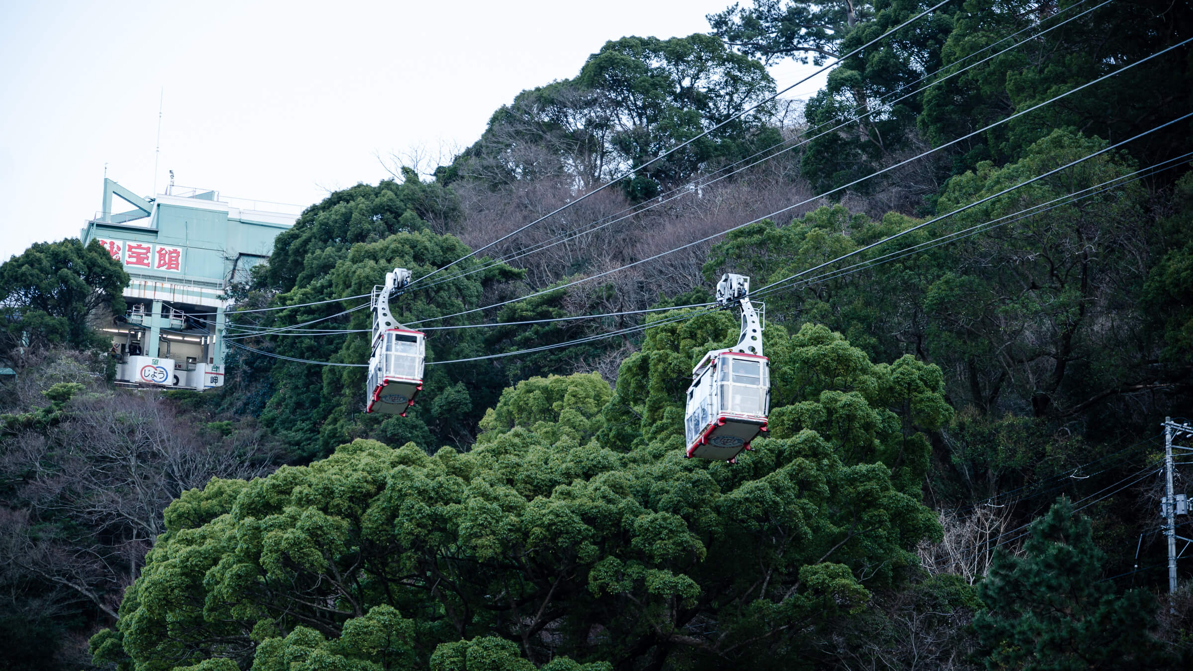
Why the Ropeway Fits the Way Atami Is Built Atami is shaped by its slope. The waterfront around Atami Sun Beach remains flat and easy to explore, connecting naturally through…
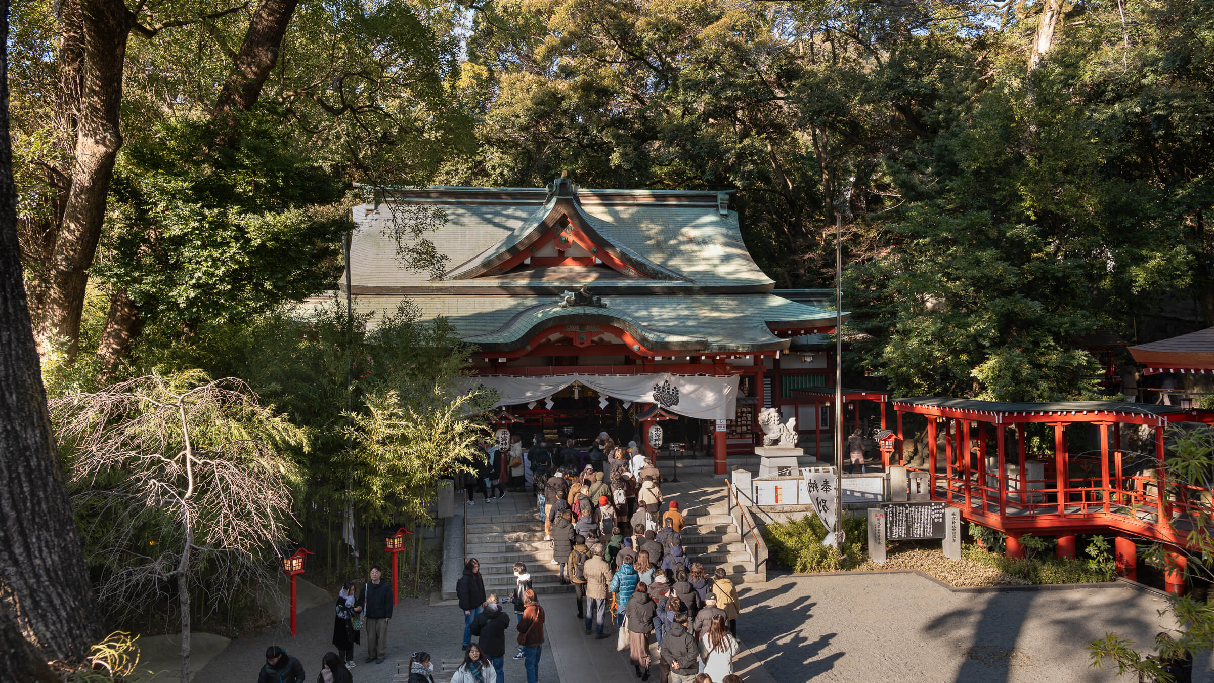
A Shrine That Reveals Itself in Stages Kinomiya Shrine does not present itself all at once. The visit unfolds in a series of short, readable segments: an approach that establishes…
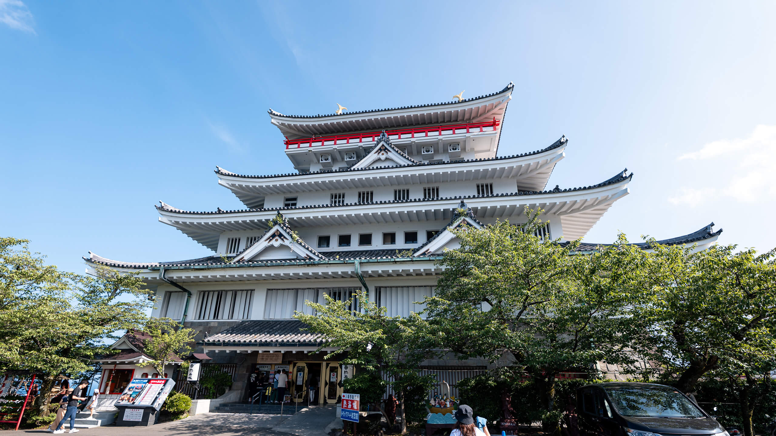
Seeing Atami from Above Atami Castle sits on a hill above the city, and its value becomes clear almost immediately. From the top, the station area, residential slopes, harbor, and…