A Full-Day Ridge Traverse Above Lake Saiko
Mount Junigatake is a full-day ridge traverse on the western side of Fujikawaguchiko in Yamanashi Prefecture, rising above Lake Saiko with a ridgeline that faces directly toward Mount Fuji. It sits within the Fuji Five Lakes area, but away from the Kawaguchiko station flow, where terrain becomes quieter and less structured.
The experience is defined by movement rather than a single destination. Twelve numbered peaks structure the route, gradually shifting from steep forest ascent into exposed rock, chain-assisted sections, and a suspension bridge near the end.
Unlike the ropeway and lakeside viewpoints around Lake Kawaguchi, which concentrate the Fuji view into a short stop, Junigatake distributes the experience across hours of terrain. The view changes with the ridge rather than remaining fixed.
This is not something that fits between other stops. The route occupies the full day, both in time and physical demand, and works best as a primary objective rather than part of a broader itinerary.
Deciding Early: Commit or Skip
This route benefits from a clear decision before starting, because once the ridge begins, flexibility becomes limited. A full traverse typically takes 7 to 8 hours, while shorter variations still require 4 to 5 hours over roughly 4.2 miles, with effort concentrated in terrain rather than distance.
The defining factor is cumulative effort. Expect approximately 1,100 to 1,300 meters of elevation gain, distributed across repeated climbs that interrupt pacing and steadily build fatigue. There is no single peak of difficulty; the effort accumulates across the entire ridge.
Terrain progression reinforces this. Lower sections remain steep but predictable, while later sections introduce chain-assisted rock, narrow ridgelines, and exposed transitions between peaks. Near the final peaks, movement slows naturally, particularly around the suspension bridge and surrounding chain sections.
This aligns with experienced hikers comfortable with exposure and sustained effort across a full day. It rarely fits into multi-stop itineraries and contrasts sharply with shorter Fuji-area stops built around quick viewpoints.
Why the Mountain Is Structured as a Traverse
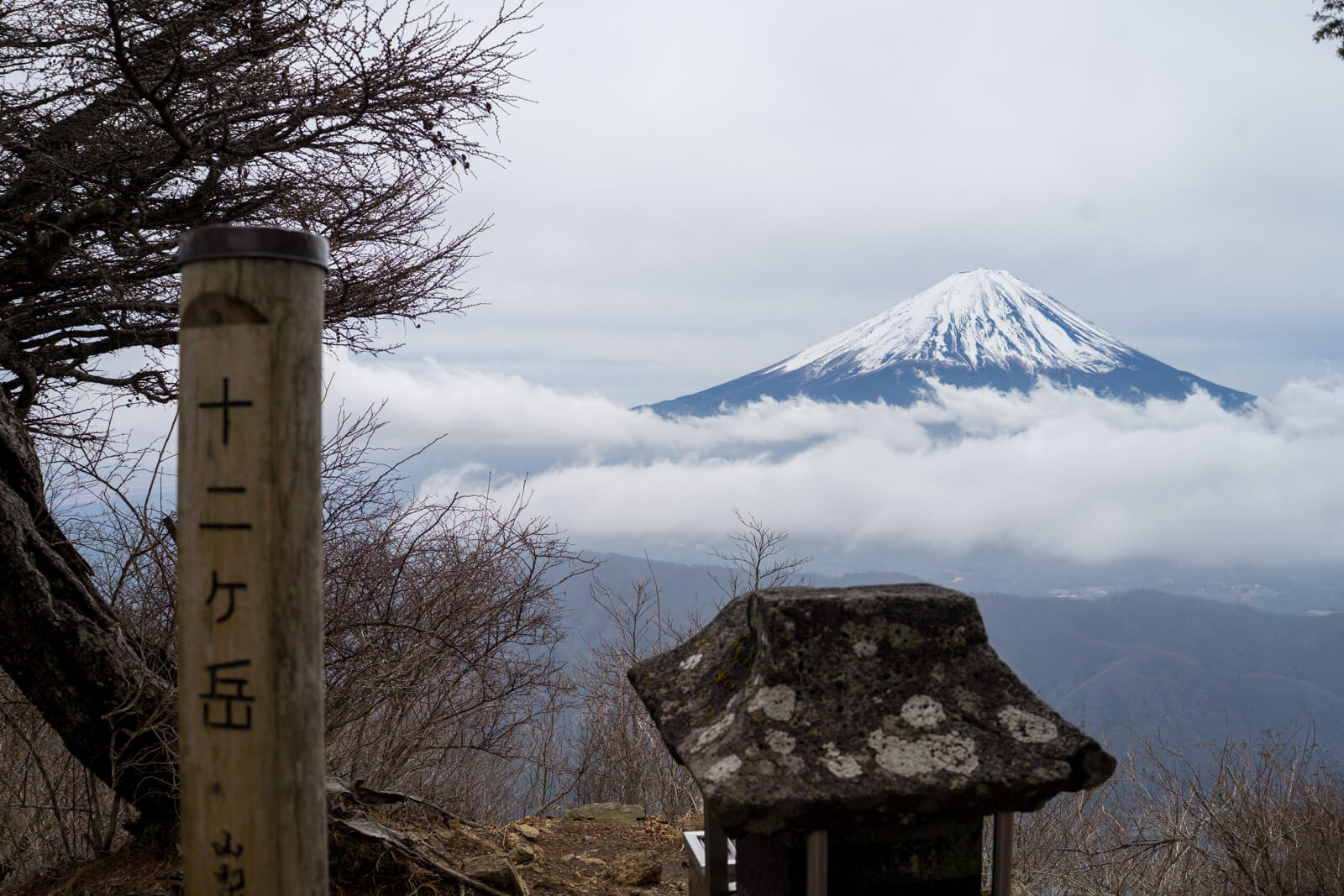
The name “Junigatake,” meaning “Twelve Peaks,” reflects the physical structure of the ridge rather than a symbolic label. Each summit is marked in sequence, creating a route where progression is measured through movement instead of elevation alone.
The ridge forms part of the terrain shaped around Mount Fuji through volcanic activity and uplift, producing serrated ridgelines rather than broad summits. This structure naturally supports traversal, where the mountain is experienced across distance.
Across the broader Fuji Five Lakes area, most viewpoints compress the experience into a single stop. Junigatake sits outside that pattern, where the landscape is understood gradually as the ridge changes direction and elevation.
Mount Fuji remains present throughout the route, but its position shifts with each peak, subtly altering the sense of scale and distance.
Climbing Into the Ridge: The Shift at Mount Kenashi
Near the Bunkado Tunnel trailhead, the route rises directly toward Mount Kenashi, establishing the physical demand immediately. The ascent holds a steady gradient through forest, with little variation in effort.
Higher on the slope, the trees begin to open, revealing partial views of the lakes and Mount Fuji beyond them. These openings provide orientation, but the climb continues without easing until the ridge is reached.
At Mount Kenashi, the structure changes. The climb transitions into repeated rises and drops, and the route shifts from gaining elevation to maintaining movement across the ridge.
The Numbered Peaks and the Loss of Easy Rhythm
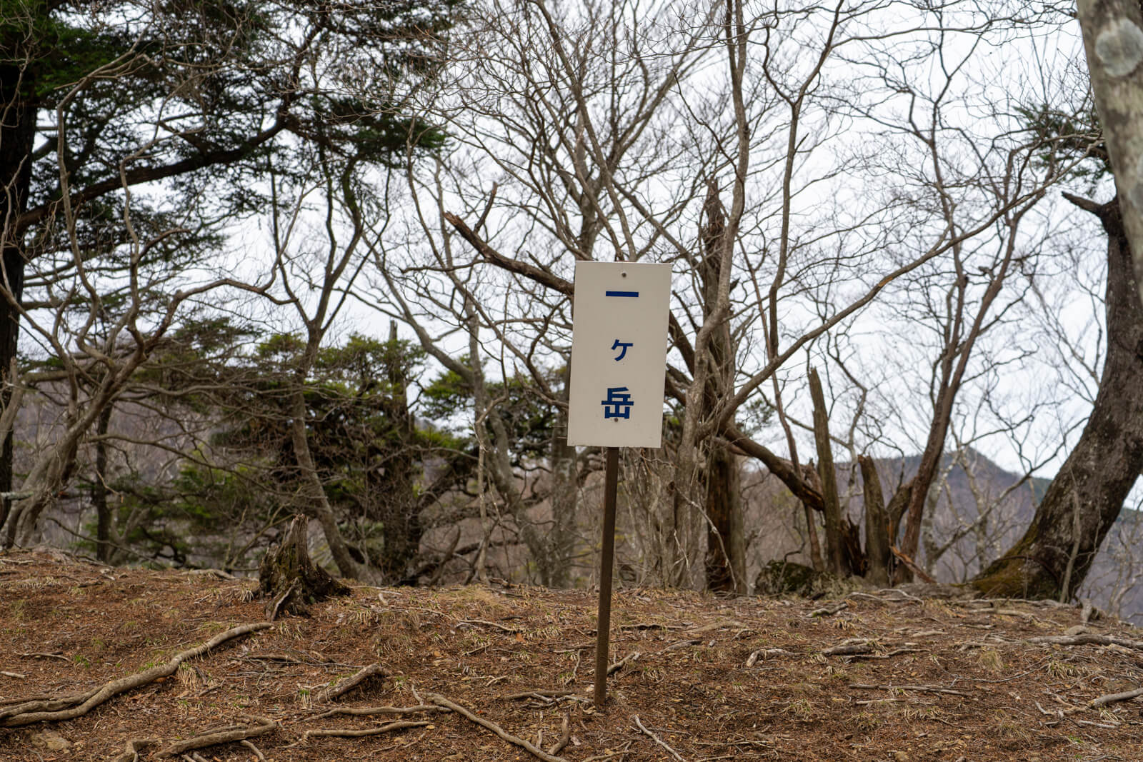
Beyond Mount Kenashi, each peak is marked in sequence, creating a clear structure that guides movement without relying on distance. Early sections allow for a steady pace, with stable footing and manageable transitions.
As the ridge continues, spacing between peaks begins to compress, and elevation changes become more frequent. The terrain gradually removes the ability to move casually, requiring more deliberate footing.
Around the midpoint, the rhythm shifts noticeably. Movement slows, and the effort between peaks increases, reinforcing the sense that the route is building toward more technical terrain ahead.
Across the basin, activity around Lake Kawaguchi continues at a different pace, highlighting the contrast between the ridge and the more accessible Fuji viewpoints.
When the Ridge Sets the Pace
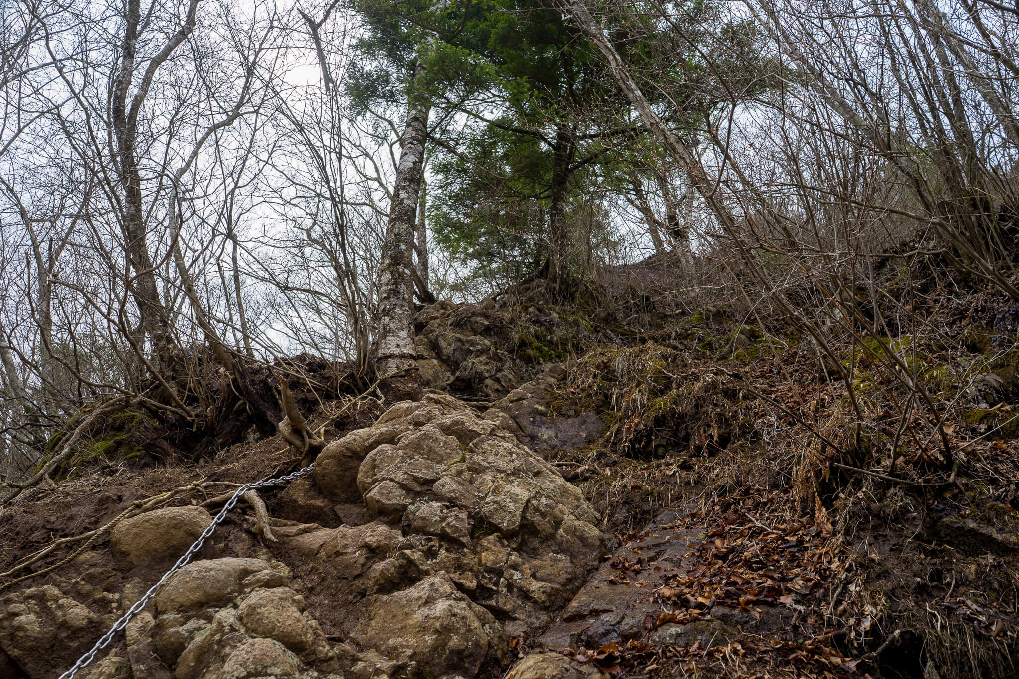
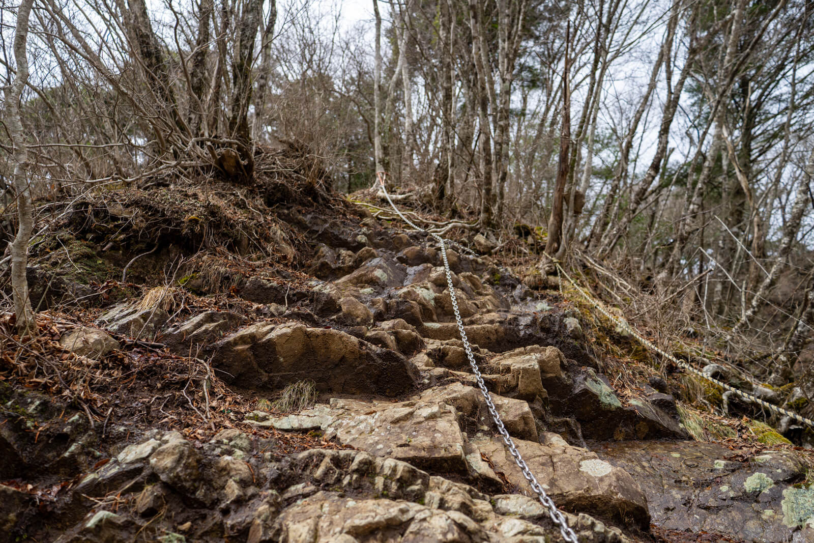
After the tenth peak, the terrain becomes more exposed and the ridge narrows, with chains appearing more frequently. The route begins to dictate movement, limiting speed and spacing naturally.
Hikers spread out as each person moves at a pace defined by comfort with exposure and balance. The focus shifts from covering distance to maintaining controlled movement across each section.
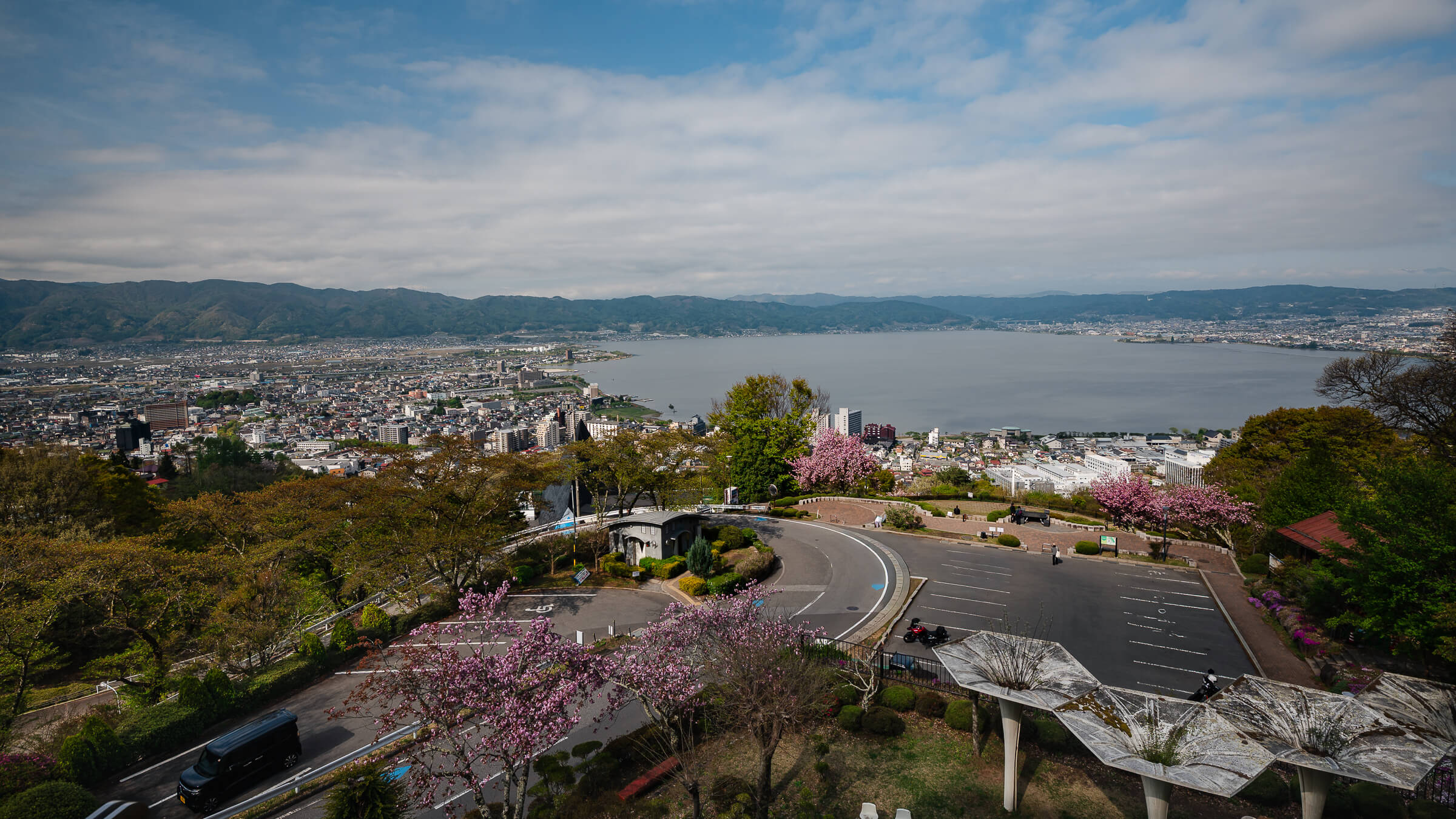
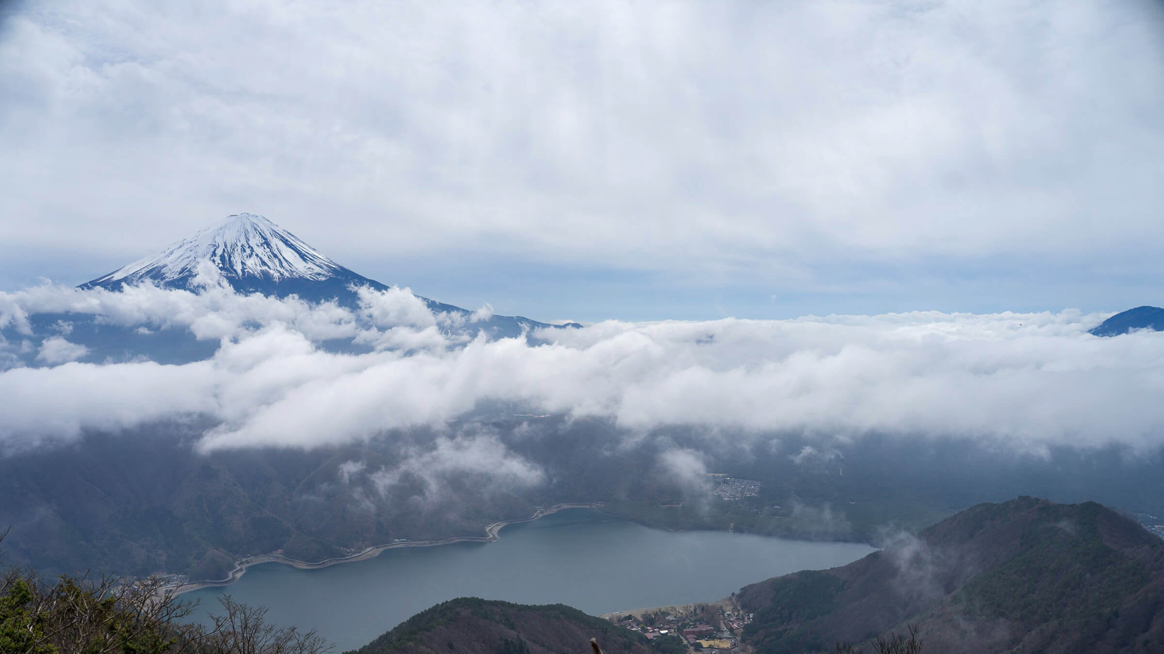
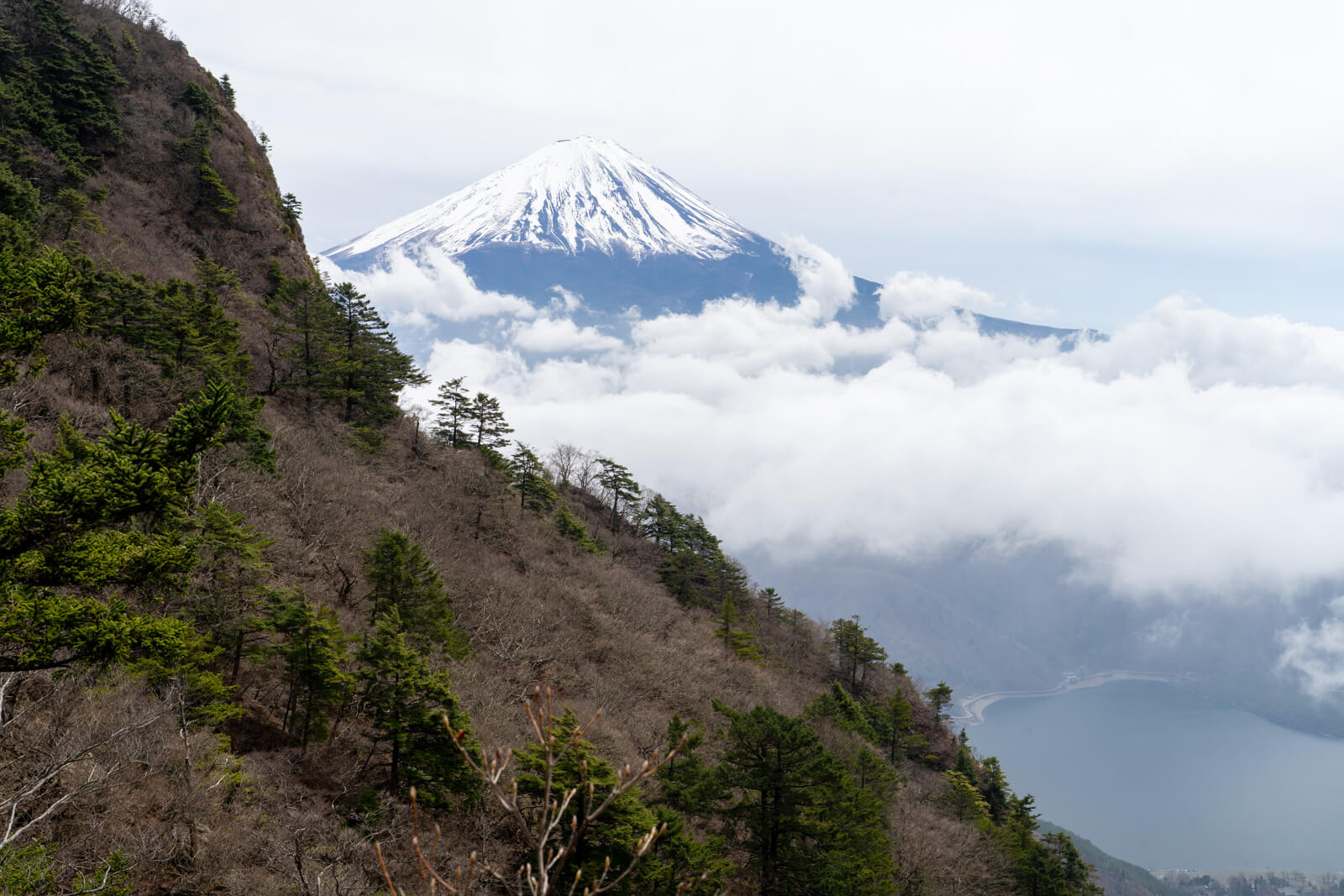
At the same time, the landscape opens fully. Lake Saiko sits below the ridge, while Mount Fuji remains in view, shifting slightly as the ridge curves and elevation changes.
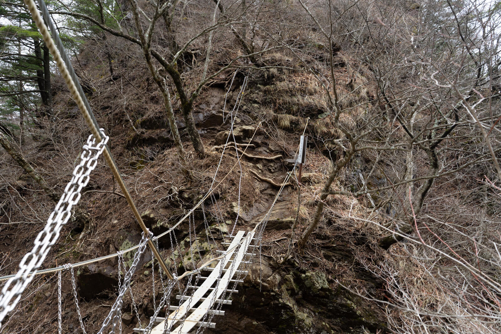
Crossing the Bridge and Finishing the Traverse
Near the end of the route, a suspension bridge links the eleventh and twelfth peaks, concentrating exposure into a single section. Movement here becomes measured, with spacing between hikers increasing naturally.
The bridge leads directly into steep chain-assisted rock, where the accumulated effort of the day is fully present. This sequence marks the final technical section before the summit.
The final ascent is short but direct. Reaching the summit completes the sequence of twelve peaks, with Lake Saiko below and Mount Fuji positioned across the horizon.
Seeing the Entire Ridge: Extending to Settogatake
Continuing beyond the summit maintains the same uneven structure, with additional elevation changes and occasional chain sections. Movement here often feels more controlled, as the rhythm of the terrain has already been established.
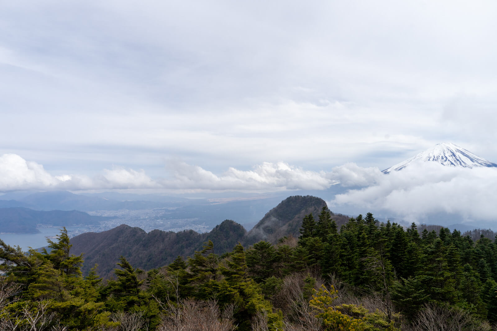
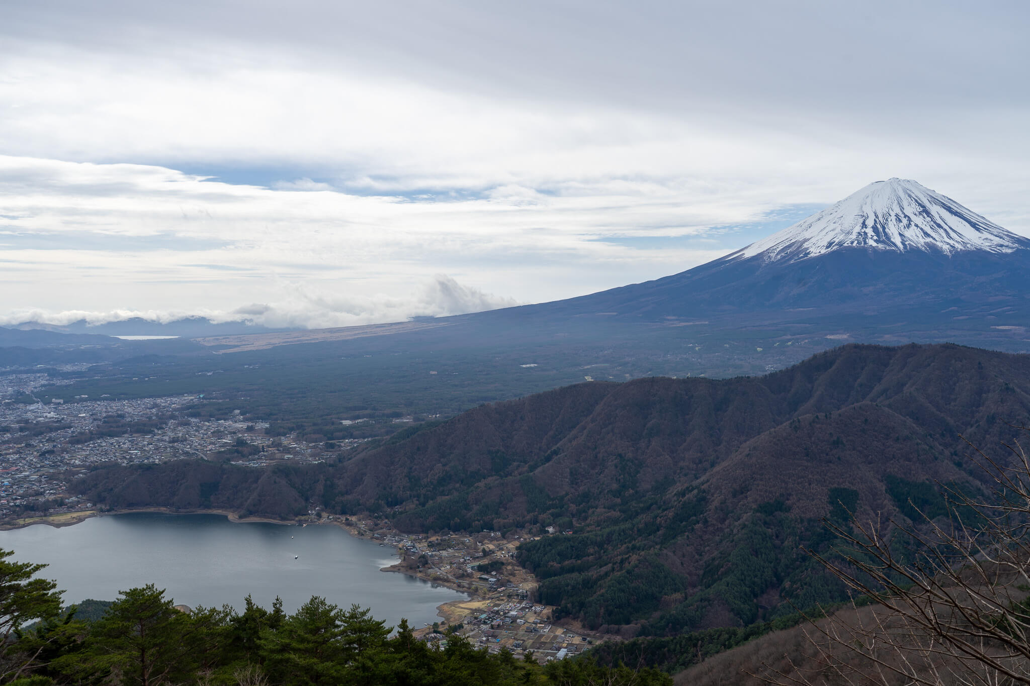
About 15 minutes past the Kanayama junction, Mount Settogatake provides a vantage point where the full ridge becomes visible. The sawtooth sequence of the twelve peaks can be seen clearly, with Mount Fuji rising behind them.
This perspective shifts the experience from moving through the ridge to understanding its full structure.
Leaving the Ridge Behind: Onigatake and the Long Descent
Beyond the Kanayama junction, the route continues toward Mount Onigatake, where the terrain begins to open and the ridgeline gradually releases. Navigation requires more attention here, as signage is less consistent than earlier in the route.
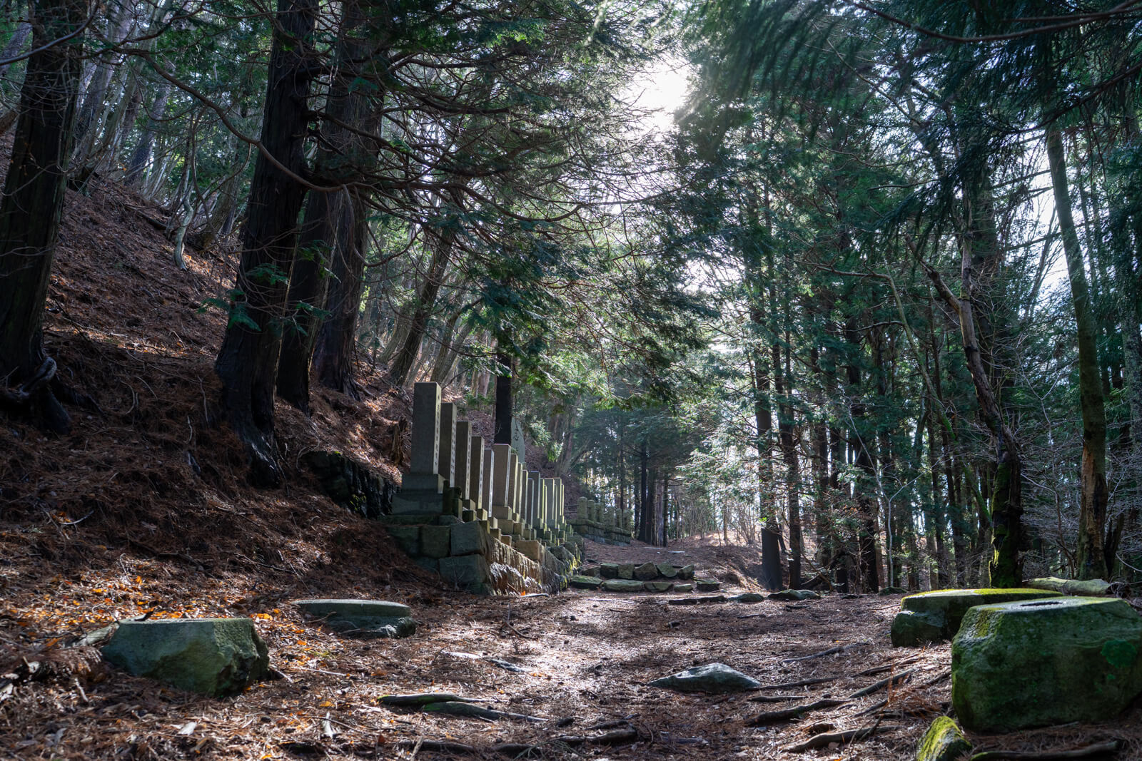
Along this section, a small stone memorial sits slightly off the trail. It remains understated and easy to pass, functioning as a local remembrance marker rather than a defined point within the hike.
From Mount Onigatake, the view shifts away from Mount Fuji toward the Southern Alps and the Kofu Basin. The descent toward Nenba follows, dropping steadily back toward the lakeside.
How Conditions Shape the Entire Day
Conditions influence this route more than most in the area, particularly along the exposed ridge where wind and visibility can shift quickly. Earlier hours tend to provide clearer views of Mount Fuji and more stable footing before conditions change later in the day.
Surface conditions directly affect how the terrain behaves. Dry rock allows for consistent movement across chain sections, while wet rock reduces traction and increases the effort required to maintain control.
Pacing naturally moderates across the route, as the terrain dictates movement rather than distance alone. Energy conserved early becomes increasingly important in the final sections.
How This Fits Around Lake Saiko
This route sits within the quieter western side of Fujikawaguchiko, where movement patterns differ from the Kawaguchiko station area. Reaching this side of the lake typically requires leaving the main visitor flow entirely, either by car or limited local transport, which naturally separates it from the more accessible Fuji viewpoints.
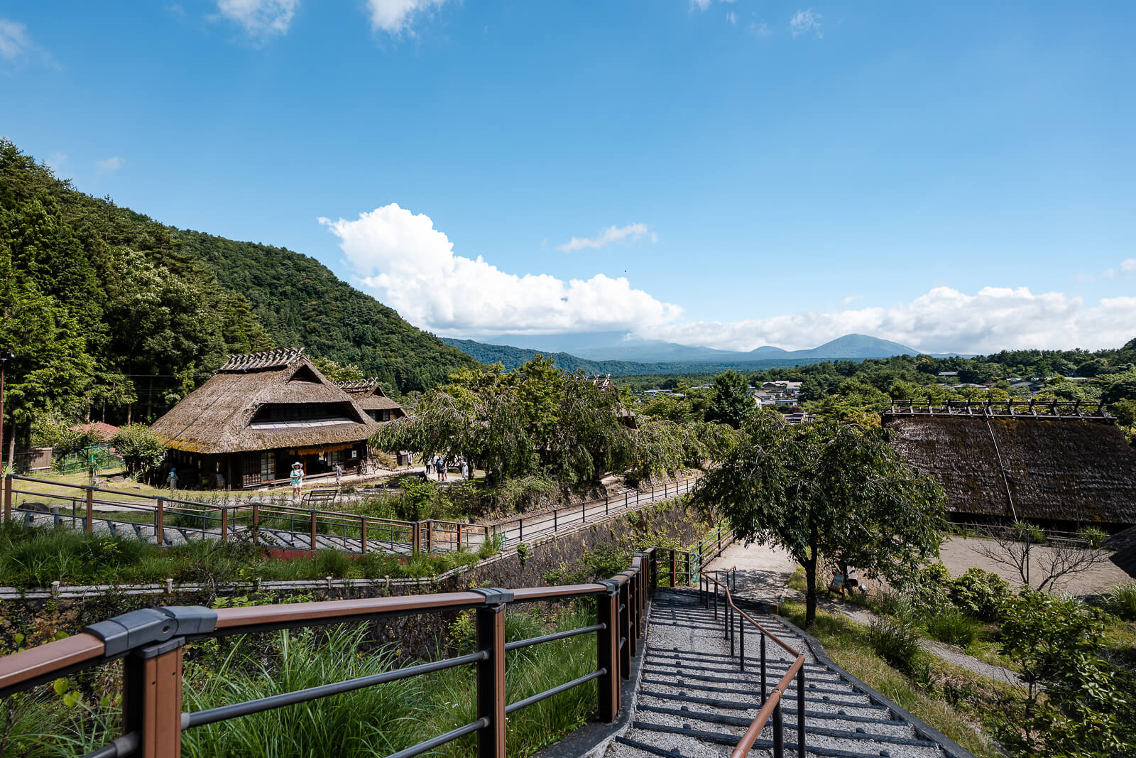
From the ridge, the descent toward the lakeside connects with areas such as Saiko Iyashi no Sato Nenba, where the landscape shifts from exposed terrain to a restored village setting. Farther east, the Kawaguchiko shoreline and ropeway follow a more concentrated visitor pattern, creating a clear contrast in how the area is experienced.
This difference is what defines where Junigatake fits. It belongs to the same region but operates outside the typical visitor rhythm.
Getting There
Access to Mount Junigatake begins on the western side of Fujikawaguchiko, where the environment shifts away from the Kawaguchiko station area into quieter roads with fewer visual cues.
By car, the most direct approach comes from the Chuo Expressway, exiting at Kawaguchiko IC and continuing approximately 20 minutes toward the Lake Saiko side. The commonly used starting point is the Bunkado Tunnel trailhead, where a small parking area near the tunnel provides access to the climb toward Mount Kenashi.
This route is often completed as a one-way traverse rather than a loop. After descending toward the Nenba side, local bus connections along Lake Saiko allow for a return toward the Kawaguchiko area, making it possible to get back near the starting point without retracing the ridge.
Public transport remains limited compared to the main Fuji viewing areas, and timing between buses can influence how the day is structured. This separation from the main transport network is part of what keeps the route quieter and less trafficked than the Kawaguchiko shoreline.
Hours & Fees
There are no set opening hours or admission fees for Mount Junigatake, and the trail remains accessible throughout the year. Conditions vary significantly by season, directly affecting safety, pacing, and overall difficulty.
Responsibility for timing, route decisions, and safety remains with the hiker, making preparation and awareness essential before starting the route.
Reaching the trailhead and returning from the Nenba side requires a bit more coordination than most Fuji-area stops, especially with limited bus timing along Lake Saiko. Planning how you arrive and exit before starting the hike makes the day significantly smoother once you’re on the ridge.